Maglić, the highest peak in Bosnia and Herzegovina, boasts a majestic rocky pyramid with a summit of 2,386 meters. It is a paradise for nature lovers, and an ideal destination for adrenaline seekers, thrill-seekers and those looking for a challenge. People have always been drawn to the highest peaks for their cultural, historical, and natural significance. These lofty summits have been associated with a country or nation’s culture, history, and traditions, and have been visited for a myriad of reasons and motivations. The majestic peak of Maglić is no exception.
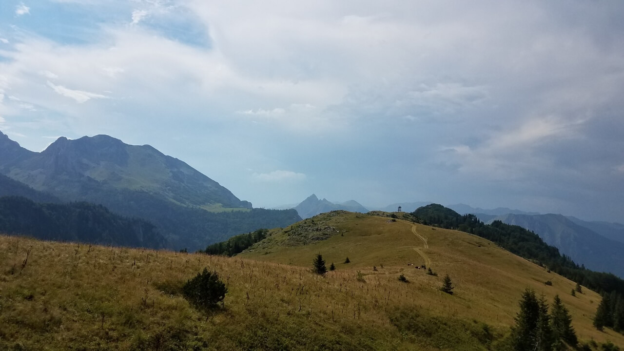
Rocky pyramid mountain of Maglić, view from Prijevor
Its captivating height has long held a special fascination for the people of this land and it is a rare privilege to be able to experience such a powerful symbol of the nation.
Maglić is part of the Dinaric Alps that stand tall along the northeastern edge of the Adriatic Sea, stretching from the Slovenian Alps to Prokletije and beyond into the Balkan Peninsula. Approximately 150 kilometers north of the Adriatic Sea, Maglić’s peak lies directly on the border of Bosnia and Herzegovina and Montenegro, with the towns of Foča and Gacko situated 30 kilometers from its base to the north and south respectively.
Here, visitors can experience a variety of contrasts in the surrounding environment. In such a small distance, visitors can find a huge mountain that symbolizes winter, height, and difficult conditions, while just a few dozen kilometers away lies a city of sunny beaches and comfort. The renowned city of Dubrovnik, made famous as the iconic Kings Landing from the hit series Game of Thrones, lies just 150 kilometers south along the Adriatic Sea coast.
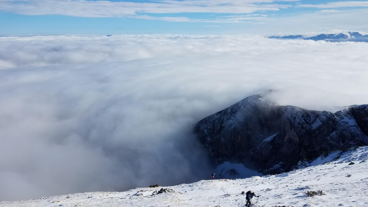
Maglić is situated in an incredibly diverse landscape. It lies between the Piva River in the east, the Drina in the north, the Sutjeska in the west, and the Volujak and Bioč mountains in the south. In the east, the mountain slopes down into the Mratinje valley, where a large dam on the Piva River can be found. To the north, the rocky peaks of Vučevo and Hadžića ravan tower with a significant altitude of more than 1,500 meters. This region of Vučevo and Hadžića ravni is blessed with an abundance of coniferous forests. Descending to levels below Maglić, we come to Dragoš Sedlo, with the largest European rainforest, Perućica, at the very foot of it.
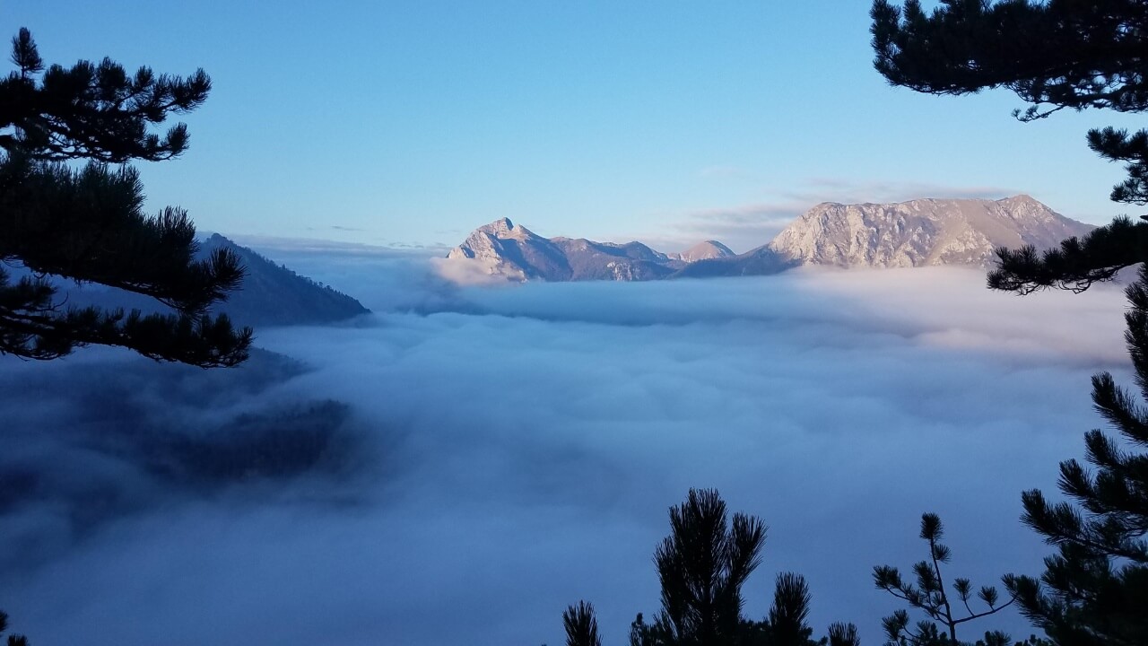
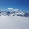
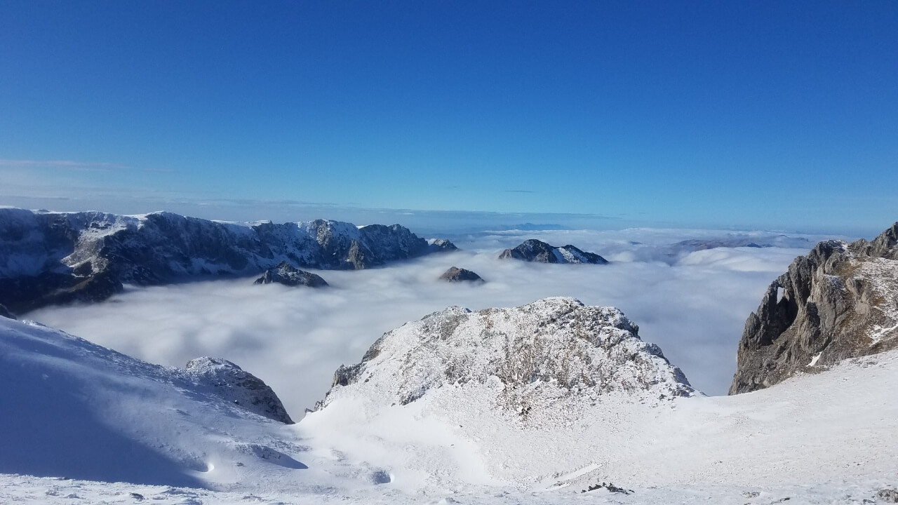
Perućica in the fog, view from Dragoš Sedlo
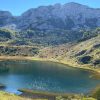
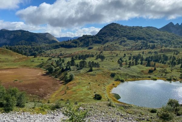
South of the towering peak of Maglić lies the breathtakingly beautiful glacial Trnovačko lake, with Volujak Mountain located just south of it, at the very source of the Sutjeska River.
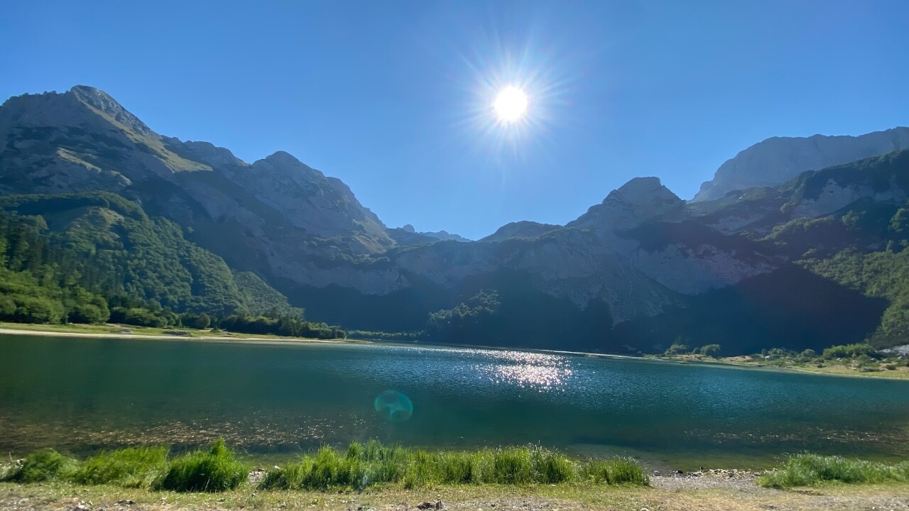
South of the peak of Maglić lies the breathtakingly beautiful glacial Trnovačko lake.
Those seeking to explore nature, test their strength and endurance, and experience a moment of intense emotion should journey to the majestic peak of Maglić. Mountaineers, hunters, scouts, skiers, nature lovers, students, and athletes alike can find challenge and adventure in the various routes to the summit, while honing their physical and artistic talents and overcoming their weaknesses. Foreigners are eager to pay a guide or experience the thrill of a winter ascent to this summit, understanding the inherent value of these types of towering mountains.
Maglić provides a unique opportunity to experience nature in all its splendor and wilderness in a direct, immersive way. From “jeep safari” on forest roads, to forest and alpine hikes, pastures, and educational activities in biology, geography, and even philosophy, to mountain climbing and mountaineering, skiing, collecting medicinal plants and mushrooms, and socializing with herders – Maglić has something for everyone!
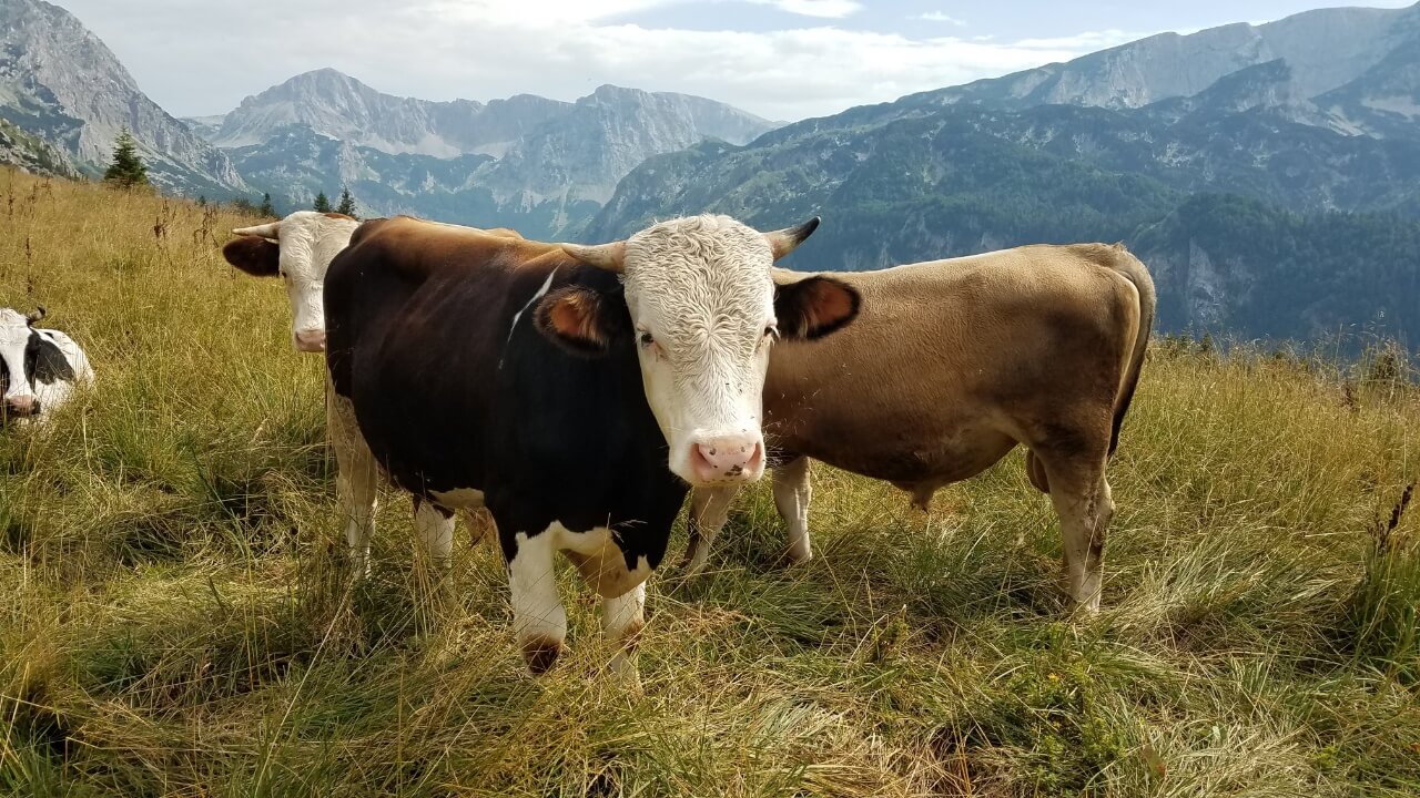
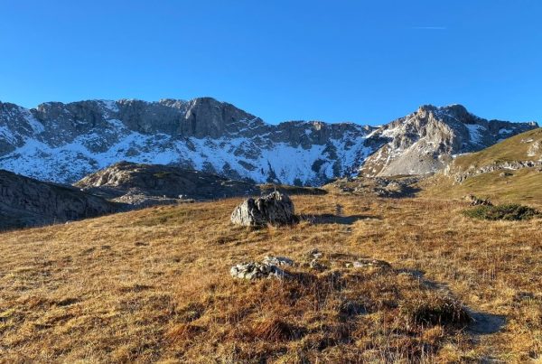
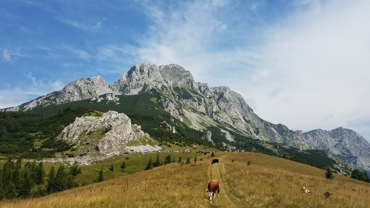
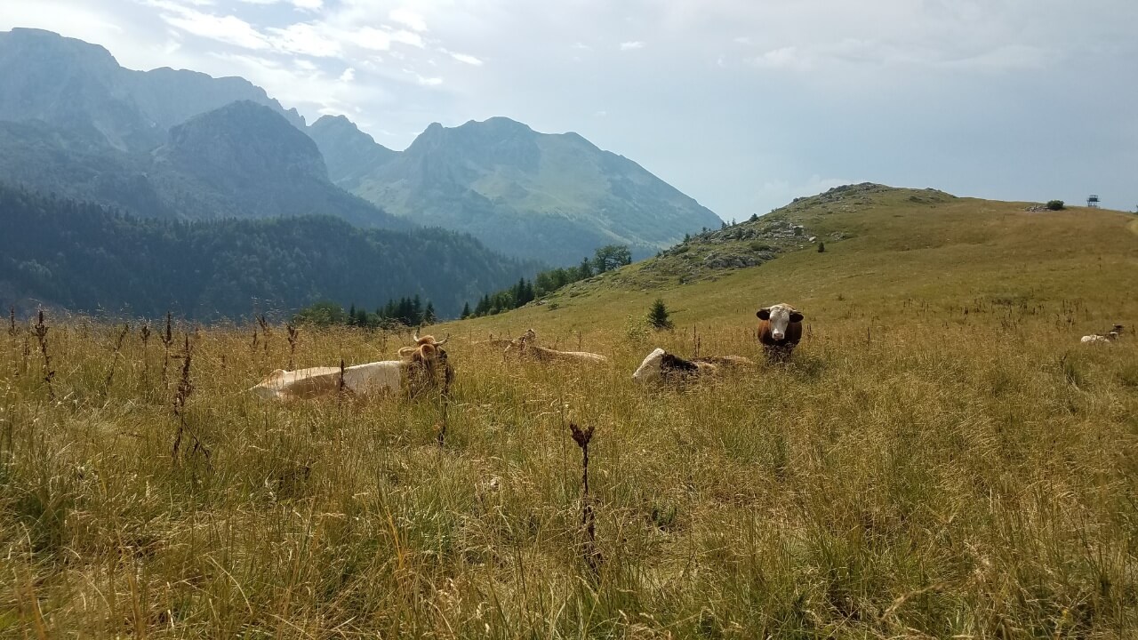
Cattle on the alpine pastures in Prijevor, at the foot of the Maglić mountain
The picturesque slopes of Maglić, cascading down into the Sutjeska or Piva Valleys, provide stunning, meaningful and rewarding tourism experiences. The slopes of Maglić boast an array of breathtaking and meaningful sights, perfect for tourists. Visitors can admire the stunning landscapes created by the mountain’s relief, as well as the wild goats that roam its accessible areas. For those seeking a more intense experience, there is the Saddle Prijevor, reachable by vehicle and a favorite spot for movies and hikers, hunters, and those craving spectacular views.
The slopes of Vučevo, the vast expanse of Hadžić Ravni, Stubice, and Carev Do, offer a unique opportunity to visitors: a chance to feel like Robinson Crusoe after just an hour or two of hiking. And if you really want to get away from it all, the Perućica rainforest adds a unique touch to the experience.
Climbers on Maglić are preparing for climbs for mountaineering expeditions from the European Alps to the Himalayas. This rugged mountain offers thousands of visitors the opportunity to recharge and find a sense of inner peace. It is a vast expanse of untouched nature, where one can truly feel alone and connected to the wilderness.
Maglić is a formidable mountain that provides thousands of people with a chance to recharge, feel joy in their soul, and find a piece of untouched nature all to themselves in its vast expanse, with few to no other people in sight. Climbing Maglić can be achieved through three main routes. We’ll explore each of these paths in turn so you can determine the best one for you.
Lokva Dernečište route
This challenging route, classified as a “Via ferrata”, is the closest and most popular ascent to the summit. It is clearly marked and provides a reliable guide for orientation. During the summer months, climbing this route requires excellent mountain-climbing technique, extensive mountaineering experience, trusty guidance, and extreme caution. In the winter, the ascent is difficult and potentially hazardous due to avalanches, thus necessitating the expertise of an experienced alpinist and a guide or extensive mountaineering and high-altitude experience.
A one-hour drive (17 kilometers) on a macadam road from Tjentište takes you to Lokva Dernečišta, 1500 meters above sea level. Here, the most popular and frequented marked hiking trail to the top of Maglić starts.
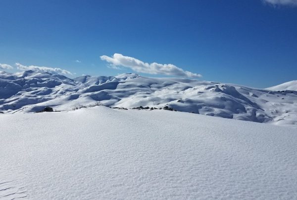
The winding road southward takes us through a mixed, primarily beech, forest. As we stroll along, we find strawberries, raspberries, blueberries, and other seasonal fruits of the woods in abundance. The gradual, yet steady, ascent brings us from the tall trees to a juniper area where the sweet fragrance of conifers permeates the air. Our journey continues through alpine meadows blanketed with vibrant blooms in the summertime, from which the peak of Maglić can be seen.
The first impression of the northern face of Maglica may initially seem intimidating, but hikers can take solace in the fact that it is traversed by a secure and established ‘via ferrata’ trail, marked and arranged before the war of the 1990s by members of the Mountaineering Society “PTT – Friend of Nature”. This is why this route is called “Postanski put” (Postman’s path).
Hikers will find this trail to be a particularly rewarding experience: after ascending alpine pastures, the path climbs towards its first rocky jump, which is ten meters in height. While this may look daunting for a mountaineer, it is here that the distinction between mountaineering and alpinism can be seen clearly. Mountaineers traverse the mountain on hiking trails, occasionally using their hands for stability and always keeping their feet firmly planted. Alpinists, on the other hand, use the rocky protrusions and hold onto the rock with their hands in order to ascend to the peak.
At this point, the hiking trail becomes so steep that it’s necessary to use your hands for support and only the soles of your shoes against the rock to make it up the incline. Fortunately, the handrails and pathways are wide enough for you to ascend safely, with a little caution, to the flat part, the small saddle atop the rock.
On a way up to Maglić from Dernečište
In this area, you can find a helpful steel cable to hold onto while you climb the exposed slope of the northeastern rock of Maglica. This route is approximately 200 meters high and stretches for several hundred meters to the south. At the top, it turns westward and features wide pathways and handrails for secure climbing, with the exception of one spot where the cable is still fixed and can be used.
To make your climb a success, three things are essential: attention, focus, and a lack of fear of heights. As you ascend, you’ll be met with stunning alpine views, well-marked hiking trails, and easy-to-follow trail markers. With each step, the scenery will become more awe-inspiring, rewarding your efforts with every meter gained.
Emerging from the road, you find yourself atop a ridge with Montenegro to the southeast and Bosnia and Herzegovina to the northwest. At a height of 2300 meters, the pyramid of Maglić peak is visible in the distance. The path continues northwest to the summit of the pyramid, though the steep climb may be daunting at first glance. However, the spectacular view from the top is worth the effort.
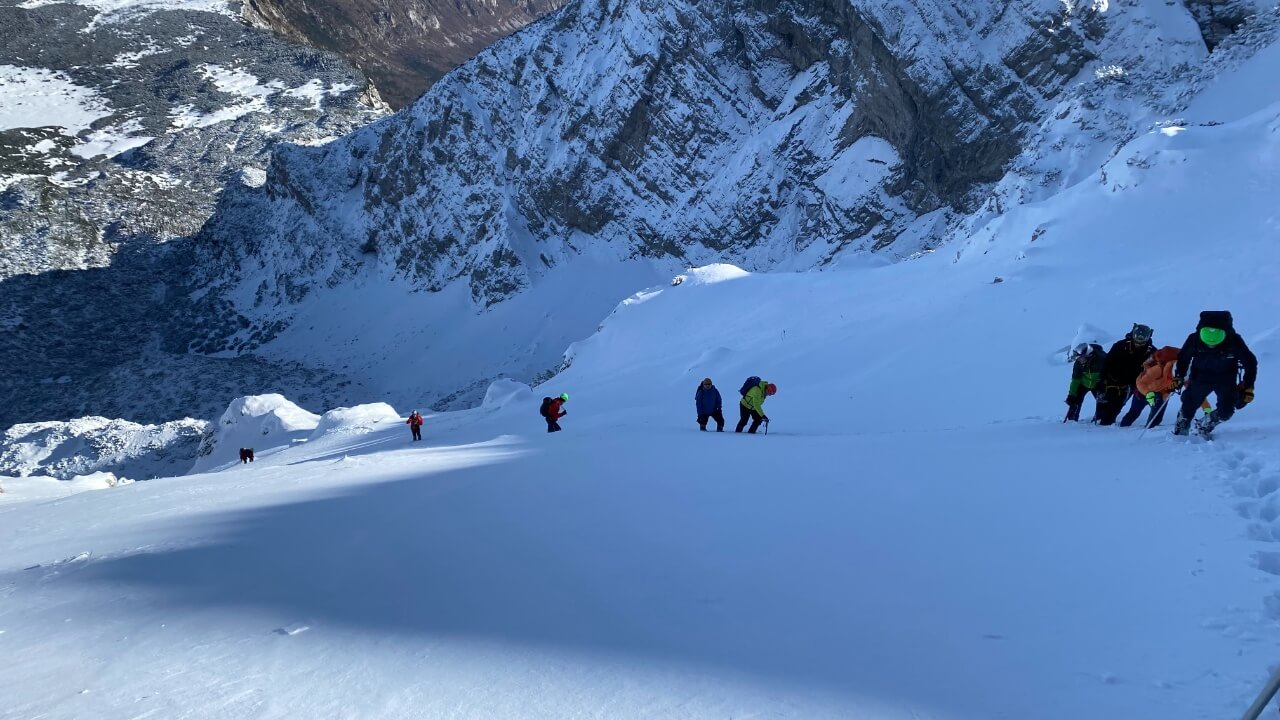
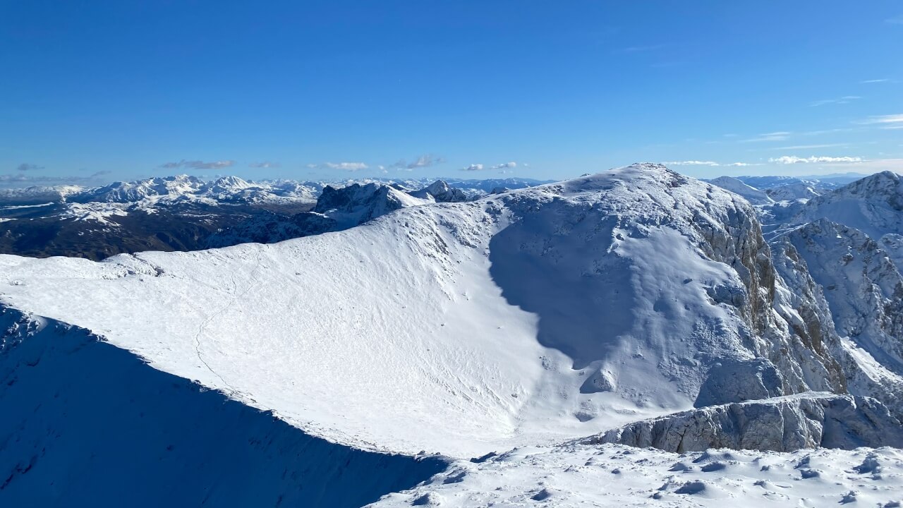
Route from Lokva Dernečište to the Maglić peak in winter conditions
As one gets closer to the summit of the pyramid peak, the path becomes increasingly exposed and daunting. The winding road up the mountain offers a breathtaking view of the final climb, making it appear more arduous than it actually is. However, the closer one gets to the summit, the more their strength and confidence wanes, and the mountain warns of the inevitable moment of truth awaiting at the top.
At almost every point of the climb up the ridge to the top, you can stand with your whole foot and hold on to the rock with your hand just for balance, so giving up before reaching the very top of Maglić would be a real shame and a wrong assessment. With the last difficulty of the ascent being acceptable, you have opened the door to a world of beauty – don’t miss out on the chance to discover it! The hiking path winds its way along the ridge, taking us to the summit pyramid. It veers to the left and comes to a vertical cut, standing ten meters tall. Large, well-maintained footpaths and handrails make it possible to ascend the cut with ease.
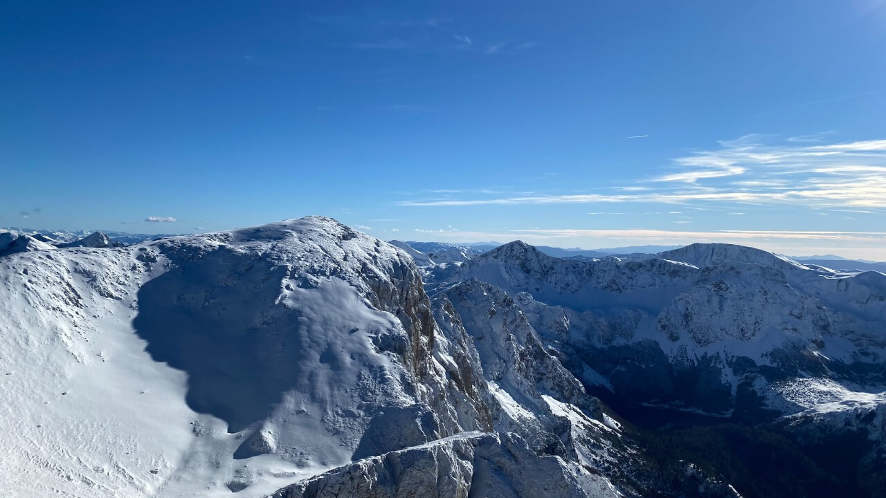
Final steps before Maglić peak, winter conditions
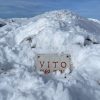
We make it to the rocky ridge, much lower than the cut. The climb is becoming easier, the incline more gradual, and after about fifty meters the peak of Maglic comes into view. On the summit there’s a sizable plateau, capable of accommodating almost a hundred people. The plateau is adorned with a mast flying a flag, a box with a visitor’s book, and a stone plaque with a text honoring the partisans and a relief portrait of Tito.
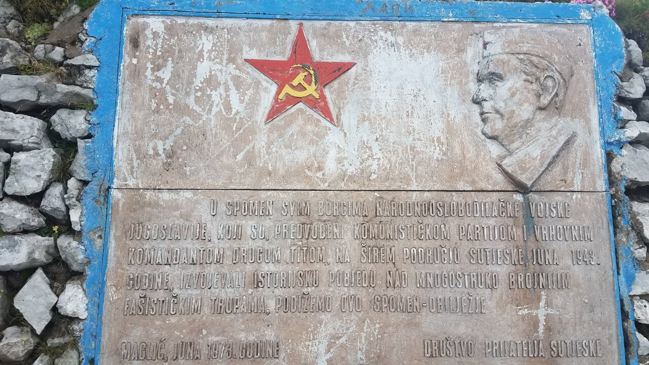
Text honoring the partisans and a relief portrait of Tito on Maglić peak
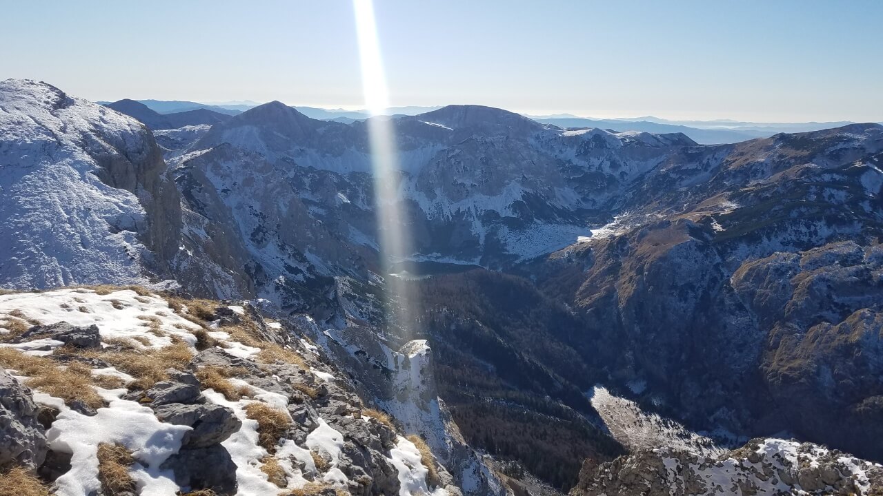
From the summit, a breathtaking panorama of the mountains can be seen: Jahorina in the north, Treskavica and Zelengora to the west, Lebrsnik, Volujak to the south, and Vlasulja, Bioč, Durmitor, and Ljubisnja to the east, all located in Montenegro. On a clear day, the Prokletija mountains in Albania can even be seen.
Witnessing the breathtaking view of Trnovačko Lake in the base of Volujak is an experience like no other.
The journey back can be done in two hours by taking the same path, or for a more scenic route, head southeast of the Bosnian peak of Maglic to Montenegrin Maglic and down the well-marked hiking trail over Carev do, where there is a spring. This journey takes three hours to reach Trnovačko Lake. Then the marked road will lead to Prijevor, and then back to Lokva Dernečišta or to the Suha valley, both in three hours.
Route from Trnovačko lake
This route requires access to the lake, which can be achieved by travelling 20 km on a macadam road from Tjentiste to Prijevor pass, located 1680 meters above sea level, under the western rock of Maglić. It will take approximately one hour to walk from Prijevor to Trnovačko lake.
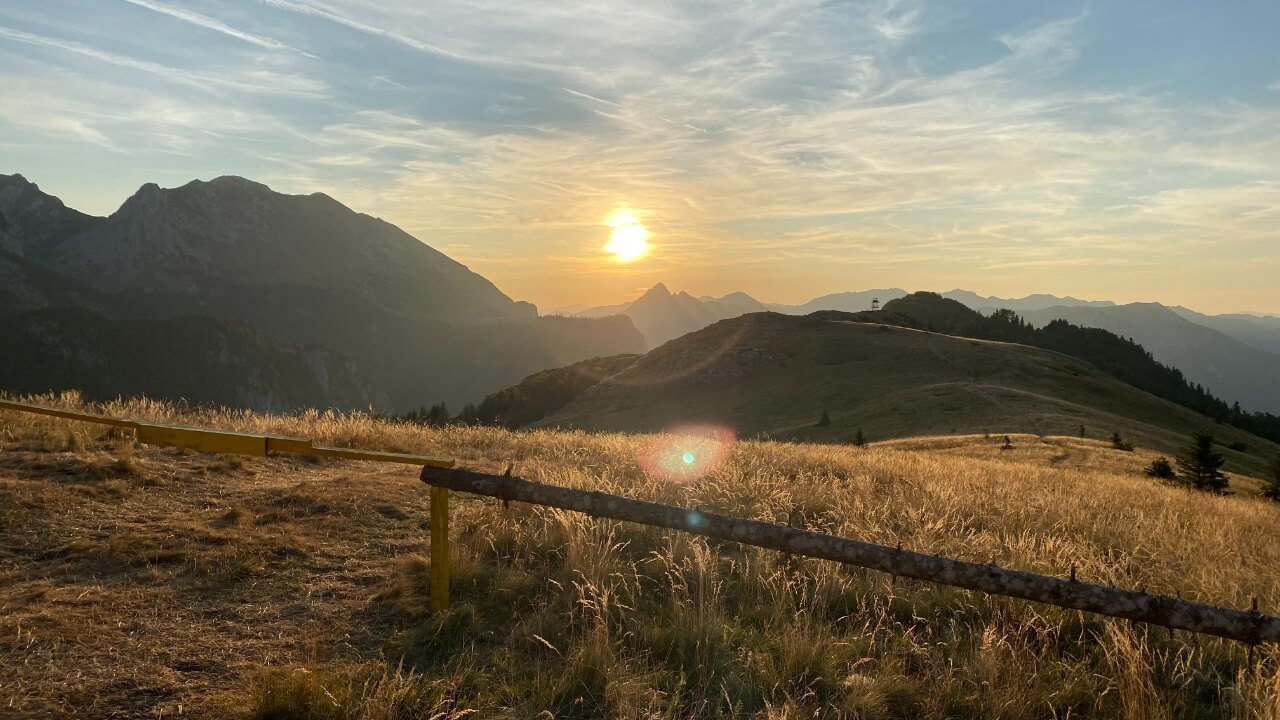
Sunset on Prijevor underneath Maglić, to the left is ridge of Volujak, while far in the distance is Zelengora mountain
The second approach to the lake is from Suha, a place 5 km south of Tjentište, on the main road towards Dubrovnik. At the beginning of the last century, during the Austro-Hungarian Monarchy, a meteorological station was located in Suha for 10 years. From Suha, a macadam forest road leads towards Maglic, which can be used with an all-terrain vehicle for at least 6 km to get closer to the lake, to the crossing over Suški potok, at a height of about 1000 meters above sea level. It is a 2-hour walk from that place to the lake.
The road from Trnovačko Lake to the peak of Maglić is a typical mountain road in the summer, marked well with no particularly steep sections. However, climbing it in the winter requires the expertise of an experienced mountaineer.
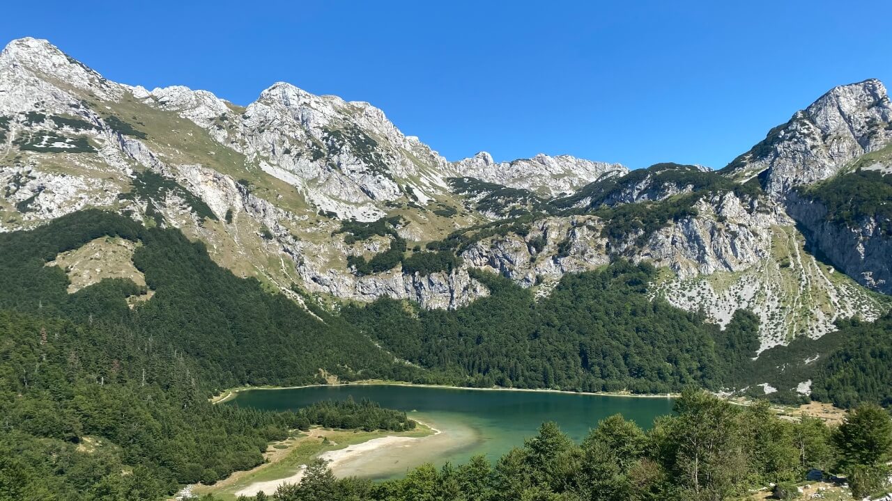
Heartshaped Trnovačko Lake
For those visiting this area for the first time, it is recommended to hire a guide or have extensive high-mountain experience, a map, and a thorough understanding of the topography. From the lake, the marked path starts from the south shore, below the peak of Trzivka, heading east and then northeast along the slopes of Šarena Lastva. At first it is a path through a beech forest, then a fir and pine forest, and finally it leads to alpine pastures, covered in a spectrum of colorful flowers during the summer months, including the Bosnian lily (Lilium bosniacum).
As you ascend higher and higher, the views of the lake and the surrounding peaks of Volujak, Vlasulja, and Trnovacki Durmitor become increasingly stunning. The climb up to the plateau will take a minimum of two hours, and the entire time the lake will remain beneath you. When you reach the peak of Sarena Lastva, the view of the lake will be absolutely breathtaking. From this altitude of over 2200 meters, you can also see Carev Do. The culmination of your journey is the reward of spectacular, sweeping panoramas in every direction. To the West and South, you will be able to admire the beauty of Zelengora and Volujak, while Tjentište valley, encircled by the Bosnian mountains, will dominate the center of the Sutjeska National Park.
Heading southeast, the majestic peaks of Mount Bioč are within reach, their remarkable shapes creating a stunning landscape, with the Durmitor peaks in the distance completing the picture. The road leads north, skirting the edge of the plateau, dotted with alpine meadows, blanketed in colorful wildflowers and populated by herds of livestock and shepherds from Montenegro in the summertime. A marked hiking trail from Hadzica ravan or from Mratinje in Montenegro converges with the road, uniting the two approaches.
As we ascend, the views become increasingly stunning. After passing Maglić, peak in Montenegro that’s two meters higher than its Bosnian counterpart, we travel along the ridge, marching along the northern rock of Maglić where the marked hiking trail from Lokva Dernečište meets us. This path leads us to the summit. We can return by the same route in three hours or take one of the other previously mentioned paths.
Maglić peak in Montenegro, viewed from Bosnian Maglić peak, left in the distance is Zelengora mountain
Maglić in Montenegro, view from Maglić peak in Bosnia
Route from Prijevor pass
Climbing to the summit of Maglić via the closest and shortest route is not only a challenging task, but also one of the most technically difficult ascents in the region. Pre-1990s, it was classified as a secured hiking route, “via ferrata”; however, due to its current state of disrepair, it is now considered an easy alpinist climb. In the summer, it requires basic knowledge of mountaineering techniques, a good level of experience, reliable guidance, and utmost attention. In the winter, it is one of the most difficult mountain approaches in Bosnia and Herzegovina and requires the knowledge of an experienced alpinist or basic mountaineering and high-altitude experience.
Prijevor pass, Maglić
From Tjentište, in one hour’s drive (20 km) on a macadam road, over the Dragos saddle and a right turn, under Mrkalj klade, you will reach Prijevor, 1680 meters above sea level. The Prijevor Pass is located under the western rock of Maglić, above the Perućica rainforest and offers a beautiful view of Zelengora, Volujak, Vlasulja, Trnovacki Durmitor and Bioč.
To reach Prijevor pass from Sarajevo by Tjentište, you can just simple follow this google maps direction on a link.
Nestled among alpine meadows, katuns, and a hunting observation post, the end of the macadam road that leads to Suha jezerina reveals the peak and western rock of Maglica. This rocky terrain is home to several alpinistic climbs of medium difficulty (UIAA scale of difficulty – III and IV degrees of difficulty), with a secured hiking trail running through the central part. Nearly thirty years ago, mountaineers from the Mountaineering Association of Bosnia and Herzegovina set up a steel cable and wedges to secure the road, but relentless weather and avalanches have since taken their toll. Suitable for experienced alpinists, guides, and high mountaineers, this challenging route requires thorough mountaineering knowledge, nerves of steel, excellent balance, and a good assessment of individual and group abilities. But, for those who dare to venture forth, it offers spectacular views, adrenaline-pumping encounters with chamois, eagles, and the ultimate mountaineering and sports success of climbing the highest peak of Bosnia and Herzegovina.
Alpine meadows, Prijevor below Maglić
The marked path winds its way sharply uphill through Alpine meadows and patches of beech and juniper forest, eventually leading us to the foot of the western Maglić rock. The ascent is steep and relentless, taking around an hour of steady walking to reach the area above 2000 meters. Carefully following the hiking trail, we will find the entrance to the rock road, located approximately fifty meters to the right of the visible ravine. The secured cable begins at this point, leading us to the summit. Most of the route is a light alpine ascent, with occasional stable and wide footpaths allowing us to keep our full shoes on the ground. The road is steep, so it is often necessary to use handrails and hold onto the protrusions in the rock for easier and safer climbing.
Mountaineers must adhere to the principles of alpinist climbing techniques, wear the necessary equipment, and observe safety standards at all times. The ‘principle of three supports’ should be applied, which means that the climber should always have contact with the rock using two hands and one leg, or two legs and one arm, while the other hand or foot looks for and uses footholds for progress. Careful selection and inspection of supports is essential to ensure that friable parts of the rock are avoided. It is important to alert others of potential falling rocks. A helmet, a 5-meter rope and one carabiner must be worn at all times.
On a way up to Maglić from Prijevor, on the left is Volujak while Zelengora is in the distance
The mountaineer will be greatly protected from any falling stones by wearing a helmet and securely fastening a rope with a carabiner to the cable. Careful climbing will ensure progress is made and the possibility of stones falling is reduced. The road winds around the rock, taking advantage of the good ledges and making climbing look effortless. However, caution must be increased where the cable has been broken by the action of the avalanche. At the peak, the last challenge is a small but vertical jump, which can be easily conquered with a slight grip on the cable. After this, the route becomes easier and more relaxed. Soon, the western rock is left behind and the summit of Maglic is in sight.
Maximum care is necessary when climbing Maglić, as careless behavior at the summit can be hazardous. The spectacular views of Trnovačko Lake, the nearby mountains, and Montenegrin mountains are just one of the rewards after the climb. For the descent, it is recommended to take the same route back in two hours; however, the descent down the rock is more difficult than the ascent. For this reason, utmost attention is a must. Alternatively, it would take four hours to return via Trnovačko Lake to Prijevor.