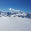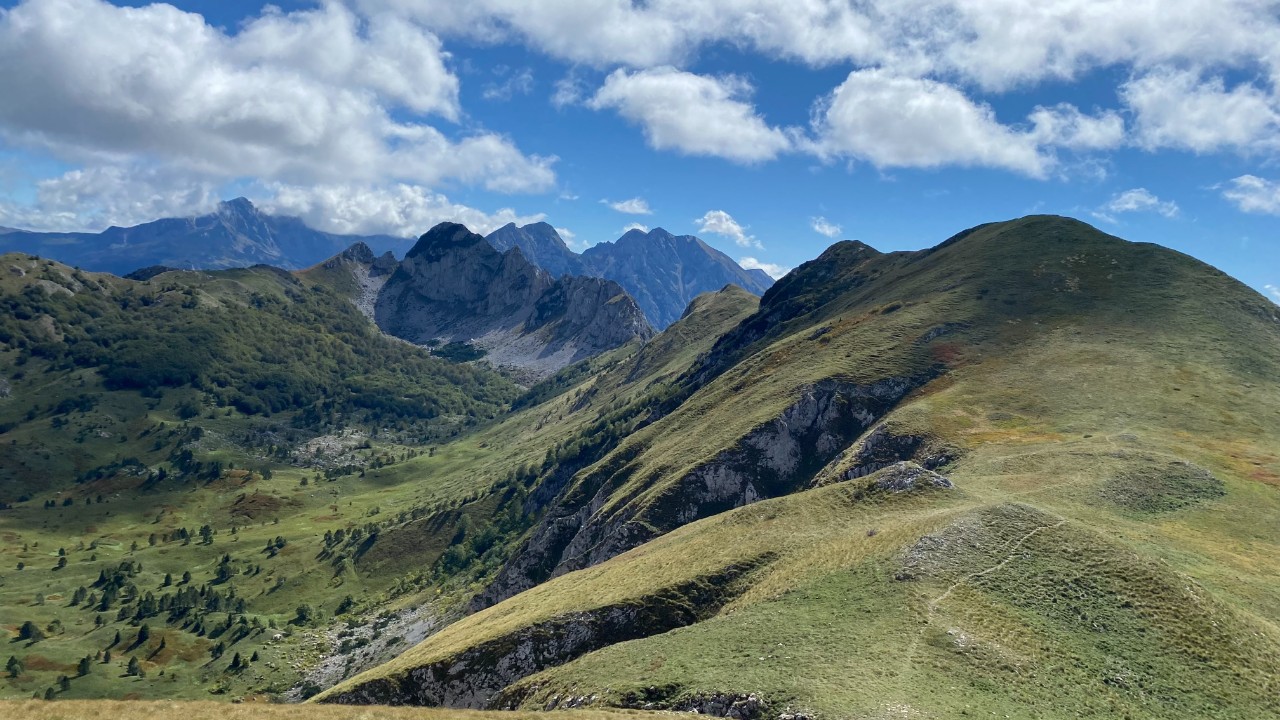
Zelengora is renowned for its beauty and tranquil atmosphere, boasting 2014 meters of elevation and being separated from Maglić and Volujak by the Sutjeska River. It is often described as an idyllic mountain, offering stunning views and numerous glacial lakes can be found scattered across the plateaus.
Mount Zelengora, the final point of the triangle of high mountains in Bosnia and Herzegovina, is home to some of the most stunning nature in the region. The Neretva river, one of the most captivating rivers of the region, originates in the western slope of the mountain.

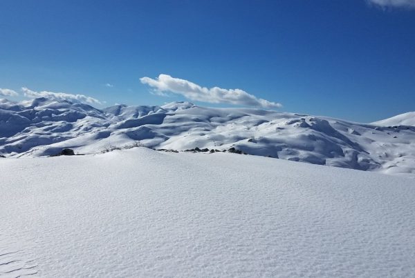
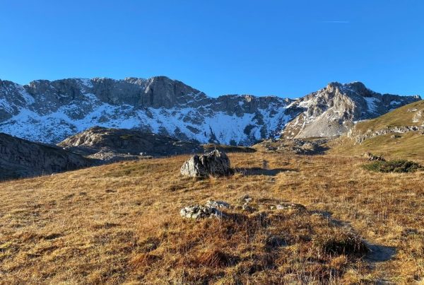
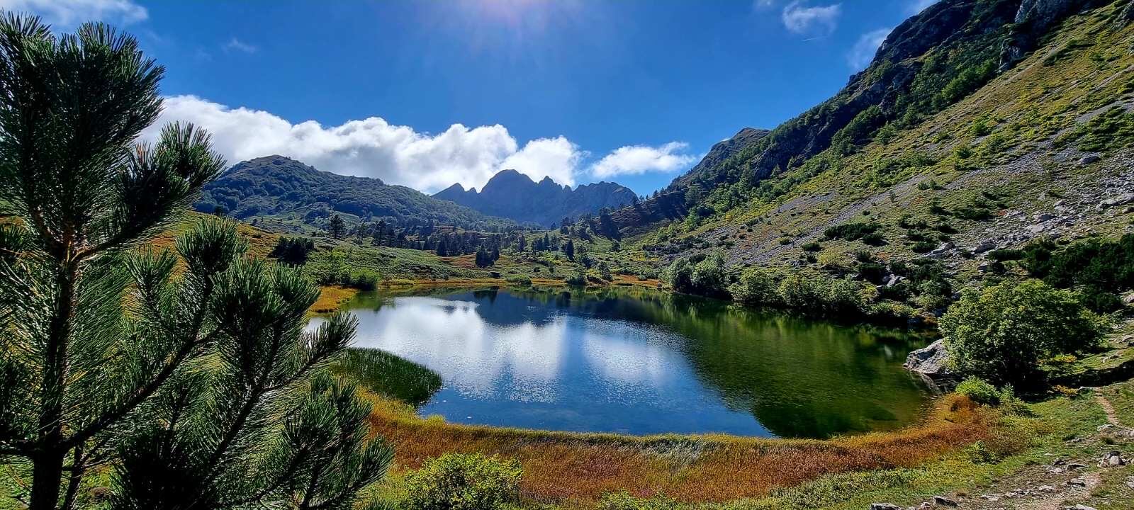
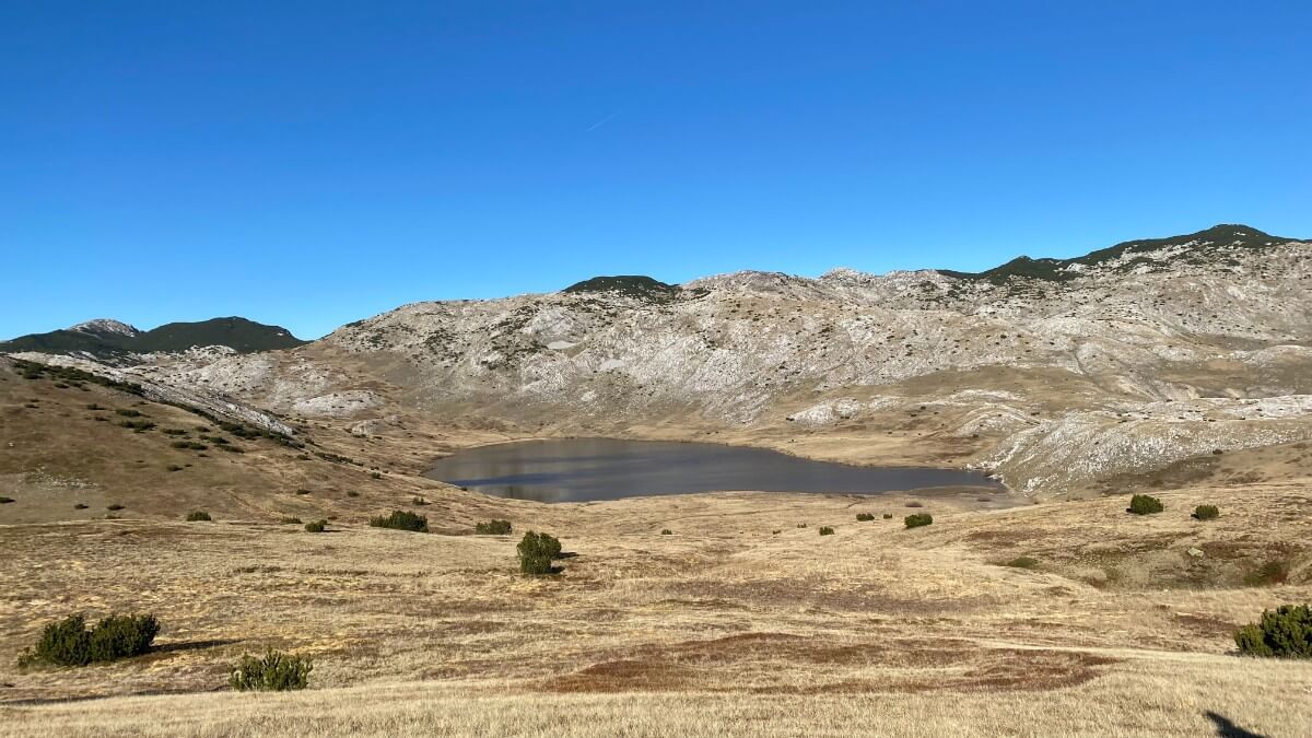
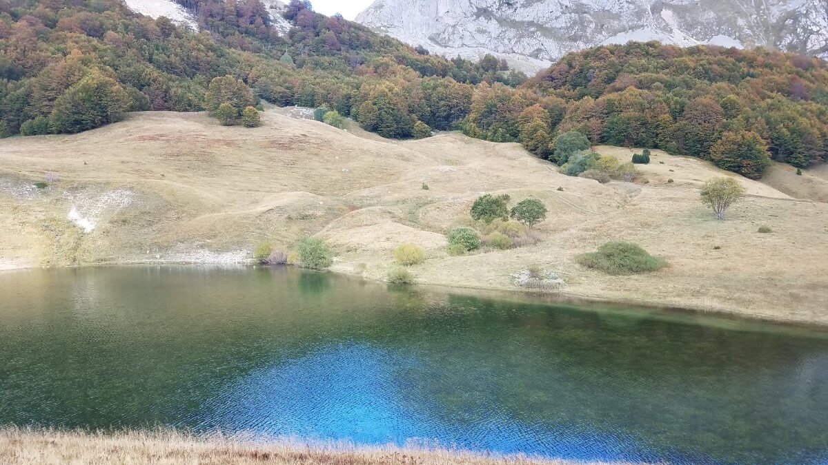
Zelengora, view captured from Kalelija peak in late autumn
Located within a 20-kilometer radius of each other, Maglić, Zelengora, and Volujak mountains share a common starting point in the Tjentiste Valley. This historical site is renowned for the failed German offensive during World War II, when the army attempted to destroy the partisans. This valley is now the center of the Sutjeska National Park and is traversed by the Sarajevo-Dubrovnik asphalt road.
Starting in Tjentište, a macadam road leads 20 kilometers to Lokva dernečište, the gateway to Maglić – the highest peak in Bosnia. This route is described in detail in the chapter on Maglić, which can be accessed through the link provided.
The Prijevor pass, located just below the summit of Maglić, is accessible via the same route from Tjentište. From there, hikers can ascend the peaks of Volujak, Studenac, and Velika Vlasulja via Trnovačko lake; for more information, please refer to the chapter on hiking tours on Mount Volujak – see the link provided.
Zelengora, a wild and enchanting beauty, is bounded by the Maglic and Volujak Mountains of Bosnia and Herzegovina. It can be reached in several ways, including from the Čemerno pass via macadam road, directly from Tjentište and from Jelašca village from the direction of Kalinovik. The Sutjeska River, like a guardian, has held back these stunning peaks and left behind a tranquil, untouched landscape of wonder. Zelengora is renowned for its enchanting beauty, which can be seen in its meadows, forests, and alpine pastures. In summer, the mountain is adorned with vibrant blooms of various mountain plants, such as gentian, bellflower, arnica, anise (salepa), marguerite, pansy, hellebore, sage, and wormwood. The lush green landscape is the source of its namesake, Zelengora, which translates to Green Mountain.
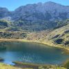
The mountain is also home to several glacial lakes, commonly known as the “Eyes of the Mountains”, including Orlovacko, Crno, Bijelo, Stirinsko, Kotlanicko, Donje Bare, and Gornje Bare. The beauty of these lakes is complemented by Jugovo jezero, an artificial lake of spectacular human-crafted beauty.
The region of Zelengora is renowned for its abundance of pristine, drinkable, and cold water sources. Decorated with the beauty of the Hrčavka River Canyon, stunning peaks, and panoramic ridges, it also hosts herds of chamois and sheep, as well as traditional summer herding settlements known as katuns. The waters of Zelengora eventually make their way to the Adriatic and Black Seas, via the Neretva, Sutjeska, and Drina Rivers. Its forests, alpine meadows, and plateaus, lying slightly off the beaten path, keep the atmosphere of untouched nature intact.
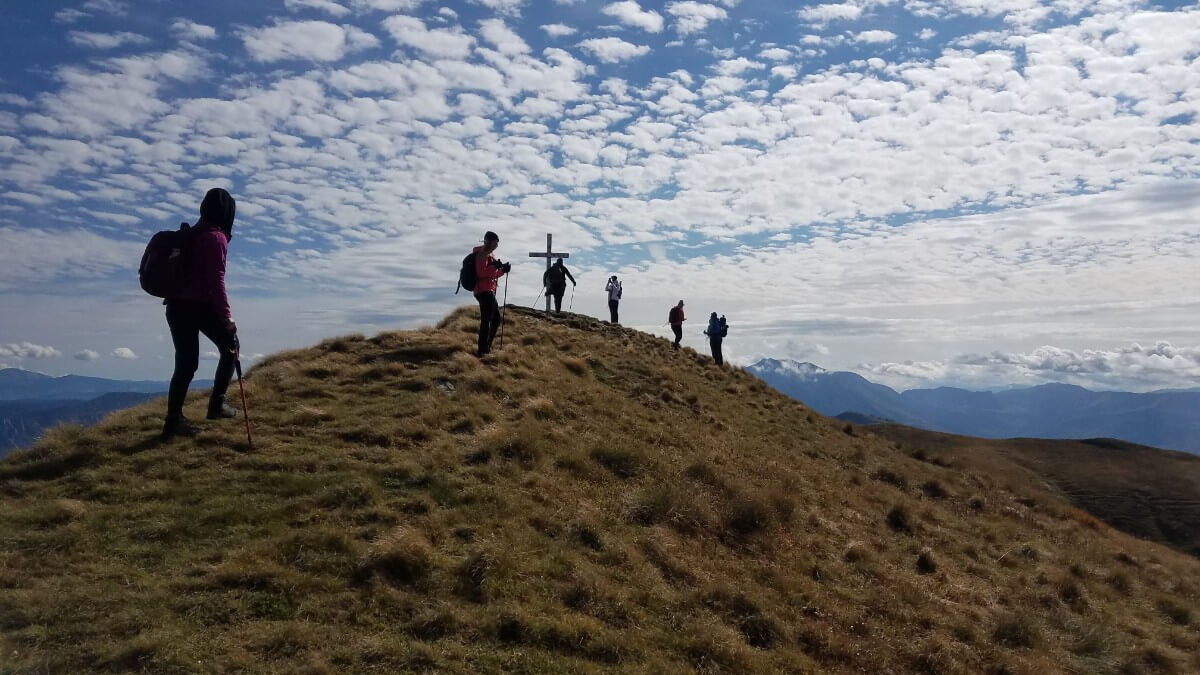
Reaching the highest peak of Bregoc, nestled at a height of 2,014 meters, promises an awe-inspiring payoff. Situated in the center of Zelengora, the summit may not be aesthetically pleasing, yet the view of the neighboring peaks and majestic mountains make the arduous climb worth it. The journey not only contains breathtaking landscapes, but also involves trekking across saddles and ridges, and past captivating lakes, making the experience all the more enriching. Thus, no visit to Zelengora is complete without scaling the peak and enriching one’s spirit.
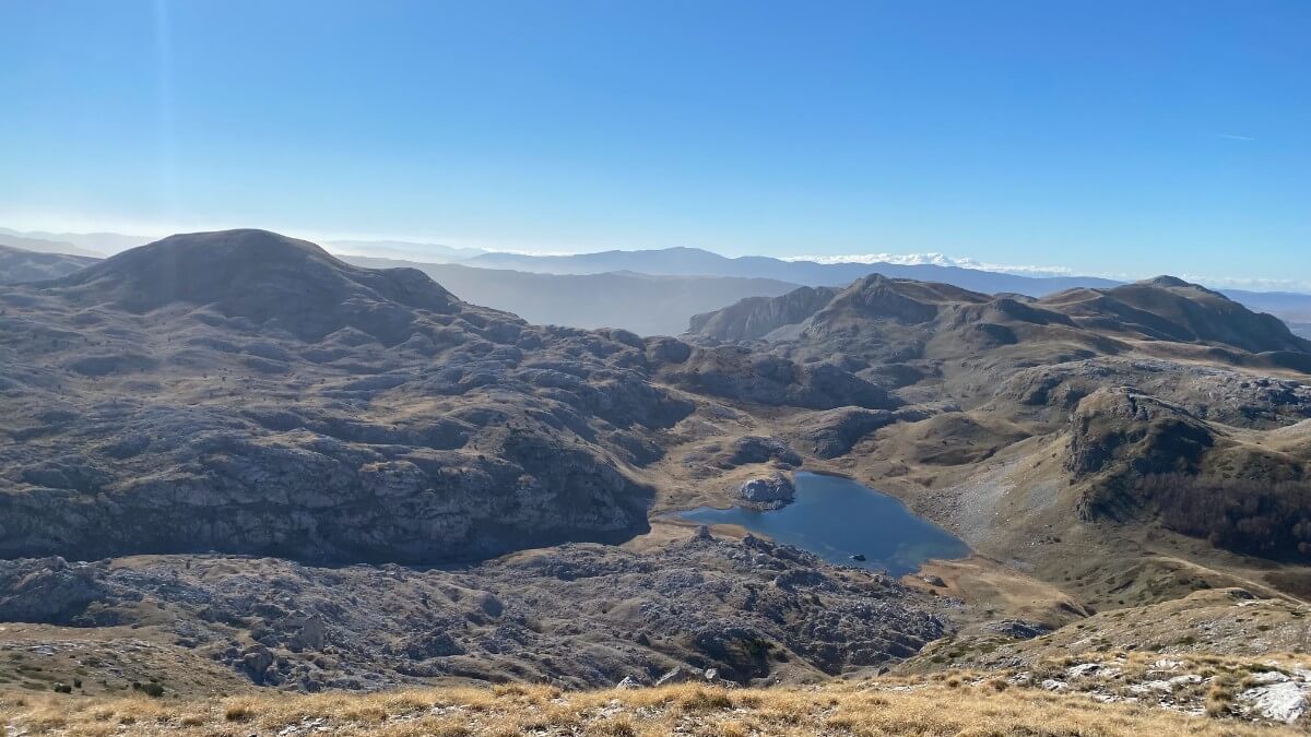
Ascent to the highest peaks of Zelengora, Bregoč and Kozje Strane, from Orlovačko Lake
The access to Orlovačko Lake begins from either direction of Kalinovik and the village of Jelašci or Čemerno pass. From the direction of Kalinovik, you will have to drive down dirt roads that are in a poor condition, making it not suitable for driving in a passenger vehicle. Similarly, the road from Čemerno pass is also dirt and in a poor condition. If you plan to make this ascent, it is best to use a robust vehicle that can handle the rough terrain. After arriving at Orlovačko Lake, the trek can begin.
Orlovačko Lake on Zelengora, Late Autumn.
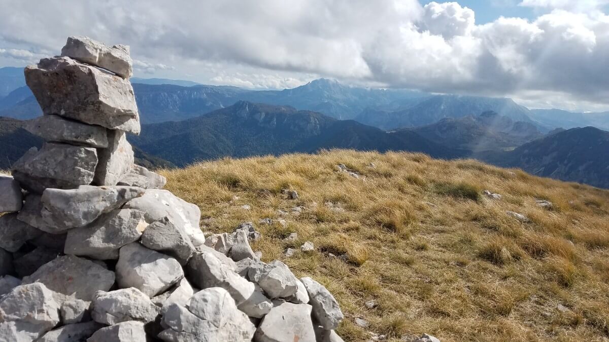
At an elevation of 2000 meters above sea level, Bregoč and Kozje Strane are the two highest peaks in Zelengora. Located a mere kilometer apart, these two peaks are a mere 4 kilometers from Orlovačko Lake and offer some of the most awe-inspiring views in the region. From the lush pastures and herds of sheep at the beginning of the journey to the wildflower-strewn ridgeline at the top, the road to Bregoč and Kozje Strane is a stunning journey filled with springs, mushrooms, strawberries, raspberries, and blueberries. From the highest point, the neighboring mountains can be seen in the distance. It’s truly a sight to behold!
Bregoč Peak, Zelengora
For winter mountaineers seeking untouched and unspoiled mountain areas, this tour promises to be an attractive experience. With multi-day ski tours and bivouacs in the snow, experienced mountaineers can access and traverse the route.In summer, the path is a high-altitude mountain path, though it does not contain any steep, objectively difficult parts. However, for a winter ascent, knowledge of an experienced high mountaineer is essential due to the distance and ridges exposed to avalanches.
Kozje strane Peak on Zelengora
For those visiting this area for the first time, a guide, mountaineering experience, a map, and a thorough knowledge of the topography are highly recommended. Starting at the lake, the path follows the herdsman’s road, steadily climbing Bregoč ridge. From the peak, the trail continues along the ridge to the north, passing over Kozje strane (2013 meters high), Orlovača (1959 meters high), and culminating at Orlovac (1962 meters high). The return journey from Orlovac to the lake can be completed in approximately one hour.
Tovarnica, Zelengora
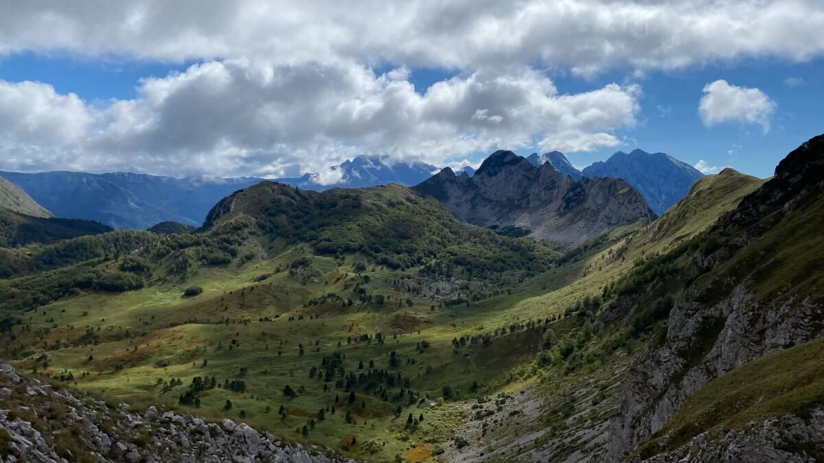
High above the Sutjeska canyon stands an impressive mountain ridge that was once cut away by a river, separating it from Volujak. Known as Tovarnica, its southern and southwestern side is referred to as Jabučke stijene, where the slopes are steep and exposed. Winding paths, raised ribs cloaked in forest and shelves of thick, lush grass are only accessible to chamois, making them the sole masters of this area.
Tovarnica could be considered as a completely independent mountain of unparalleled beauty, sure to captivate even the most discerning of nature lovers. With its highest peak, Ugljesin vrh, at 1,859 metres, as well as Ardov (1,723 metres), Planinica (1,620 metres), and Siljevica (1,722 metres) peaks, and its two lakes – Donje and Gornje Bare – it is an indelible part of Zelengora.
Ardov Peak, part of Tovarnica, Zelengora
Surrounded by rocky cliffs almost a thousand meters in height, this is a natural habitat for chamois and eagles. Here, neither wolves nor bears can enter, allowing the environment to remain in perfect balance. Home to a variety of wild animals, Zelengora is a bounteous source of sustenance.
To reach this breathtaking spot, take the macadam road from Tjentiste, from the direction of Foca. At the entrance to Tjentiste, turn right after the bridge over the Hrcavka river. Drive past the memorial monument to the legendary partisan commander Sava Kovacevic. At the sixth kilometer, bear left and the macadam road will lead you to Donje Bare Lake after fourteen kilometers.
Zelengora hiking tour: Donje and Gornje Bare lakes – Ugljesa’s peak – Tovarnica – Planinica
The starting point for this tour is Donje Bare lake. To get to the starting point from Sarajevo, drive the M18 road and take the route to Foča via Trnovo. Turn right onto the M20 road before Foča. At Tjentište, turn right when you see a sign for Donje bare. Continue for 7 kilometers on a bad asphalt road, then drive another 13 kilometers on macadam. Park your car in the parking lot above the Donje Bare lake. And keep in mind that the entrance to Sutjeska National Park is paid.
Donje Bare Lake, Tovarnica, Zelengora
This hiking tour begins at Lake Donje Bare and takes us through some of the most beautiful parts of the mountain. Along the macadam road, we will take a half hour walk back to the direction from which we came, before veering west out of the forest and into alpine pastures. At the end of the ascent, we will be rewarded with stunning morning views of Tovarnica’s eastern slopes, Zelengora, and the chance to spot some forest animals. Starting the journey in the early morning ensures that we will witness the majestic scenery in all its glory, bathed in the morning sun.
Gornje Bare Lake, with Planinica and Ardov Peak in the distance, Zelengora
The ascent up Ugljesa’s peak is a challenging mountain climb that will test your fitness and determination. As you ascend, you will feel your heart rate and pulse quickening in anticipation of reaching the summit and the stunning views of Zelengora, Maglic, and Volujak.
Ugljesa’s Peak, Zelengora
The ridge continues to the southeast, taking you to Tovarnica pass and then to Planinica. It is generally nicer to descend from the peak of Ardov in a northerly direction, returning to your starting point within an hour, instead of retracing your steps.
Ugljesa’s Peak, View of Tovarnica ridge, with Planinica and Ardov on the right, in distance, Zelengora
Hiking tour on three lakes on Zelengora: Orlovačko, Štirinsko and Kotlaničko jezero
Take a journey to the western side of Zelengora and marvel at the two stunning lakes it has to offer. As you ascend through the mountain, you’ll be taken through some of its most picturesque parts. Your experienced guide will be able to show you the tracks of the local wildlife, giving you the opportunity to observe their behavior up close. Embark on a unique and unforgettable mountain tour, and explore the untouched areas of Zelengora’s plateau.
The city dwellers may have seen animals in the zoo, but the mountaineers can meet them in their natural habitat in the mountains. The forests, bushes, and brush of lakes are home to chamois, roe deer, foxes, rabbits, and birds, while eagles and hawks can often be spotted soaring above Zelengora.
If the visitor is eager and ready to explore, they can view the mountain with an experienced mountain guide, who will help them get to know the landscape. Alternatively, those guests wishing to go it alone can do so at their own pace, taking in as much as they wish. In either case, they will be rewarded as even the worst day spent in nature is better than the best day spent in front of the television! The summer route of the mountain is a high-altitude road, consisting of markings and livestock tracks, with no particularly steep inclines that might be considered difficult to traverse.
For those who are visiting this area for the first time, it is highly recommended to hire a knowledgeable guide or experienced mountaineer to assist with navigating the topography. Beginning at the picturesque Orlovačko Lake, this road winds its way west up a livestock path, passing beneath the peak of Kalelija at 1977 metres. Offering breathtaking views of Zelengora, this route is said to be one of the most beautiful in the region. Here, you can view the 1949-meter-high Todor peak, as well as the lakes on both sides of the ridge. The road continues west to the Štirin area and the lake of the same name, located at an altitude of 1,677 meters.
The road from Orlovačko lake turns southwest and after 4 km it descends to Kotlanicko lake, located at an elevation of 1514 meters. It takes 2 hours of walking to return to Orlovačko lake, passing through Borovno brdo pass.
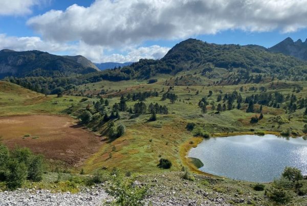
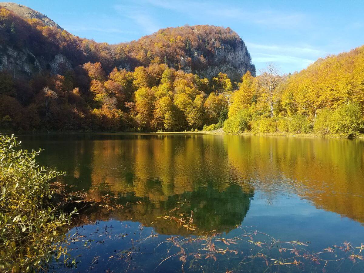
Jugovo lake on Zelengora
Located near Orlovacko lake, Jugovo lake is an artificial lake, 250 meters long and 100 meters wide, created by the gamekeeper Jusuf Jugo in the last century. Its beauty captivates all who visit, and its trout population is sustained by the yearly introduction of young rainbow trout. To fish, a permit must be purchased from the National Park Sutjeska or at the lake itself. The stunning views of the nearby Kalelija and Stog peaks make the lake’s position within Zelengora all the more remarkable.
Jugovo Lake, captured from Kalelija peak on Zelengora, with Stog Peak in a middle
Štirinsko Lake on Zelengora
Štirinsko Lake is the largest lake on Zelengora, stretching 600 meters in length, 300 meters in width, and reaching depths of 4.5 meters. It is situated west of the peaks of Todor (1,949 meters) and Osredak (1,828 meters). Abundant with lake goldenrod and bush birds, fishing is prohibited from November 30th to June 1st. If fishing is attempted, it must be done using one rod with a limit of three hooks and artificial bait, and no more than five fish can be caught in a single day.
Nestled away from any roadways, the tranquil lake offers complete serenity and an almost perfect silence. With its captivating landscapes, natural water sources and towering peaks, the area around the lake is perfect for camping, walking, and hiking. The peak of Kaleliji, standing at 1977 meters, is a must-see and is less than an hour away from the lake. From the peak, you can witness the most beautiful and thrilling part of Zelengora, providing a breathtaking view.
Štirinsko Lake on Zelengora
The peacefulness of Štirinsko Lake on Zelengora and its surrounding mountain meadows make it an ideal destination for those seeking a break from the hustle and bustle of the city life and its associated alienation from nature. In the near future, the number of visitors is expected to rise significantly as people seek to reconnect with the beauty and magic of the Zelengora mountain. With no human intervention, the lake and its surroundings will remain a tranquil and exciting escape.
Kotlaničko Lake on Zelengora
Kotlaničko Lake is a truly special place. Its turquoise waters, framed by the surrounding peaks, create a stunningly beautiful landscape. The lake is located at an altitude of 1875 m, making it the deepest lake in Zelengora. Despite its inaccessibility, it remains untouched by human hands.
Kotlaničko Lake, on Zelengora
Located in a beautiful landscape, Kotlaničko Lake is one of the most beautiful glacial lakes in Bosnia and Herzegovina. The closest access point is less than a 2-hour walk from the Borovna Brda pass, close to Jugino Lake. The road to the lake starts at 1700 m, from the saddle itself, next to the spring, just below the characteristic rock, which is about 5 meters high. The area is marked with mountain markings, which can help with orientation.
Kotlaničko Lake is an awe-inspiring site, with its turquoise waters and majestic peaks around. It is a truly special place, and its untouched beauty is a sight to behold.
Kotlaničko Lake is situated in a stunning, glacial-carved cirque at the base of the majestic Zelengora mountain range. It is 400 meters long, 200 meters wide and 10 meters deep. The lake hosts a variety of animal life, including the rare and endangered species of newt, as well as lake goldfish.
Fishing is permitted in the lake from June 1 to November 30. Regulations dictate that anglers may only use one rod, with three hooks and artificial bait. The minimum length of catchable fish is 30 centimeters, and the daily catch limit is three.
The lake is supplied by several springs, which feed into a sinkhole at the foot of the mountain. This sinkhole is said to be the source of the mighty Neretva River.
Donje Bare Lake on Zelengora
Donje Bare Lake lies beneath the peak of Ardov, which stands at 1723 meters high. The lake is 250 meters long, 120 meters wide and 4.5 meters deep.
Donje Bare Lake, late autumn on Zelengora
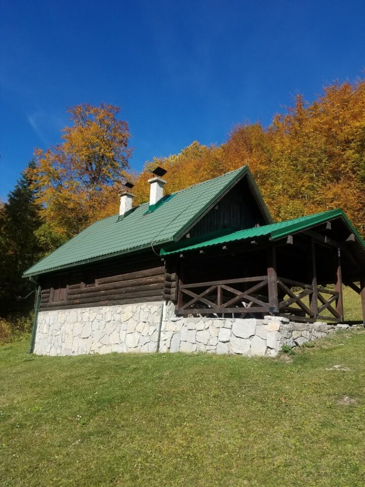
Mountain House on Donje Bare Lake, Zelengora
Before the 1990s, there was a villa near the lake, reserved for the use of Josip Broz Tito. Only a select few were allowed to stay there. Unfortunately, the villa was destroyed during the war, but a smaller, yet beautiful hunting lodge was built in its stead. This lodge is managed by the Sutjeska National Park, and is open for guests.
Rainbow trout have been introduced to the lake, which contains crystal clear water. Its springs rise from the west coast, and its bottom has a deep blue hue.
Surrounding the lake is a landscape of alpine pastures, dotted with juniper and other types of pine, and below with beech. Roe deer and chamois can be seen in the area, if one is patient enough. Donje Bare Lake is the perfect place for an active vacation, as it is close to the beautiful Zelengora area.
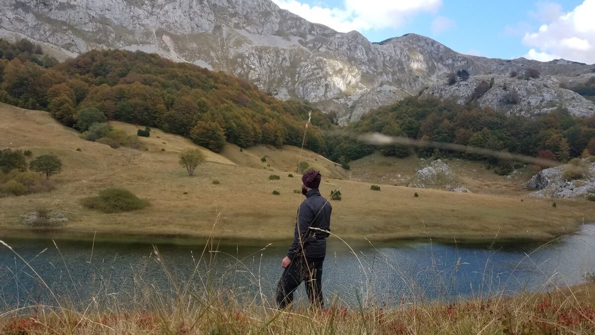
Orlovačko Lake on Zelengora
Located in the midst of a mountain, this 5-meter deep lake is 330 meters long and 75 meters wide. Its crescent-shaped body of water is crystal-clear and home to an abundance of fish. During the summer months, it is an ideal spot for swimming.
The temperature of the lake water can vary from 5 degrees Celsius from the point where it enters to the point where it leaves. Its surroundings are lush with wild animals, and the vast pastures are brimming with medicinal plants during the summertime.
Orlovačko Lake on Zelengora
The lake is part of the Sutjeska National Park. To learn more about the park, follow this link. To ensure visitors’ comfort, a high-standard hunting cabin was recently constructed near the lake. Here, highland katuns (traditional settlements) of Bosnian highlanders still exist, with herds of sheep, cows and horses. The area around the lake offers a variety of activities, including fishing, hunting, picking mushrooms, forest berry fruits, and collecting medicinal plants.
In addition to these activities, the area of Orlovacko Lake provides the opportunity for people to stay here and enjoy the fresh air, high altitude, and a host of other activities. These include sports training, school in nature, art and photography colonies, hiking, mountain climbing, skiing tours in winter, and mountaineering climbs. Camping is also available. For those who wish to explore a larger part of the mountain, Orlovačko lake is the ideal starting point. There is a variety of one-day tours that can be taken from this location, offering the chance to experience the beauty of the mountain.
Trebova mountain, Zelengora
Trebova Mountain is part of Mount Zelengora, and it is home to two stunning peaks—Planik (1,796 meters) and Velika Kosuta (1,872 meters). Other notable features of the area include the Treskavac peak (1,803 meters), the Livestock Settlements of Lučki Katun and Vrbnička Koliba, and the plateau of Ljubin Grob.
The area is well-known for its incredible beauty. White pine forests line the Hrčavka River, and the Vrh Treskavac peak is surrounded by magnificent rock formations. The landscape shifts from rainforest to alpine meadows, creating an unforgettable atmosphere. On the northern side of the mountain, coniferous forests lead to the Bijelo and Crno lakes. Further north, the ridges of Orlovac, Kozije Stijene, and Bregoc Peaks can be seen.
Driving to Trebova Mountain from Tjentiste requires taking a 22 km road. After 10 kilometers, the road veers right, crossing the Hrcavka River bridge before proceeding westward to Dobri dol. The road surface is mostly macadam and follows a path through the forest and meadows, passing the Ljubin grob monument and ending at the Lucki katun.
For those wishing to access Trebova Mountain by foot, the journey begins in Tjentiste, passing Popov Most and the village of Krusevo before reaching the Lucki katun after a 3-hour walk. Nestled in the region are several newly built livestock huts of highlanders from the area that offer a unique camping experience. The friendly hosts will welcome travelers with open arms, making it the perfect base for exploring the nearby lakes and hiking trails.
During the summer, the pastures are alive with herdsmen and their flocks of sheep. This is thanks to the grazing rights won through court proceedings since the time of Austria-Hungary. Nature lovers take advantage of the opportunity to pick mushrooms, forest fruits, and medicinal herbs, or simply relax. School holidays bring children to the mountains, who help their parents and grandparents fill the area with cheerfulness and joy, and learn life lessons.
At dawn and dusk, the view stretches for miles, from Maglic to the Montenegrin mountains – a sight that must be seen to be believed. If you’re looking to experience the untouched, bridal beauty of Zelengora, a visit to Trebova mountain is an absolute must.
Lucki katun – Ljubin’s grave – Bijelo lake – Crno lake, Zelengora
This road takes you through some of the most stunning parts of the mountain, connecting key elevations and leading you to the Bijelo and Crno lakes. Here, you can reach the central ridge of Zelengora, the highest peak of Bregoč, and Orlovacko lake. This tour is the perfect beginning or end to your mountain adventure. Whether you’re looking for a way to acclimatize to the altitude, train for more difficult climbs, or just have a peaceful, long walk through some breathtakingly beautiful areas, this road has something for you.
Just an hour’s drive from Lucki Katun lies the monument Ljubin Grob. The picturesque road to the monument is known for its stunning alpine meadows, which are covered in a variety of wildflowers during the summer months. Knowledgeable visitors can also find a host of forest fruits, medicinal plants and mushrooms along the route. With a keen eye, bird nests are even visible among the grassy tufts, making the path a veritable feast for the senses.
To the west, the skyline is dominated by the central ridge of the mountain, with Kozje strane rising 2013 meters high on the left and Orlovac reaching 1962 meters on the right, behind which is Orlovačko Lake. In the next half hour, the landscape changes from alpine meadows to pine, juniper and dense forests. Further northwest, the road descends into the cirque of Bijelo lake. This lake lies at the foot of Orlovec’s eastern slopes and stands at an altitude of 1450 meters.
Bijelo Lake is an impressive body of water located in the heart of the mountains. It measures 90 meters long, 70 meters wide, and is 2.5 meters deep. The lake has an emerald-green hue, hence its nickname “Green Lake”. While there are no fish in it, the shoreline is lined with mountain mint, providing a beautiful backdrop for photos or a unique opportunity for mountaineering. Atop the shoreline, a striking rock rises high, making it an ideal spot for striking shots or honing one’s climbing skills.
Just half an hour away to the north, lies the tranquil Crno Lake, almost hidden in the forest. If you know how to recognize mountain flora and fauna, the path leading up to it is like a journey through an alpine botanical garden – simply take a careful step and take a look, and you will be rewarded.
Crno Lake is located at an altitude of 1450 meters, stretching 170 metres long and 80 metres wide, with a depth of 3 metres. It is teeming with brown trout, making it the perfect spot for flyfishing. The lake is managed by the Sutjeska National Park, and camping is allowed next to both lakes.
For those who are looking for an adventure-filled one-day tour, the Lucki katun route is an ideal option. There are no objective obstacles on the path, so anyone can take it, although having a guide to help with navigation is recommended for those who are not experienced mountaineers, hunters, or nature lovers with a good knowledge of topography and a suitable map.
The return trip takes the same path and can be completed in less than two hours. Or there is an option from Bijelo lake to climb up the central ridge to a pass 1800 meters high. From there, it takes two hours to make it to Orlovacko jezero. Alternatively, you can go back by ascent in the direction of the south, that takes three hours and it passes by Orlovac peak (1959 meters high) to Bregoč, and then to Dobri dol and Ljubin grob. This will lead to Lucki katun in two hours.