National Park Sutjeska is the oldest and largest national park in Bosnia and Herzegovina and home to the last remaining rainforest in Europe. It is also home to the highest peak in the country, Mount Maglić, which stands at 2,386 meters. The park is known for its historical significance as the site of the 1943 Battle of Sutjeska during World War II.
The park encompasses a wide mountainous area on the border of Bosnia and Herzegovina and Montenegro, and is bordered by the rivers Piva, Drina, and the headwaters of the Neretva. It is surmounted by the mountain massifs of Bioč, Vučevo, Maglić, Volujak, Lebršnik, and Zelengora. The park preserves one of the most diverse and unique ecosystems in Southeastern Europe, with a total area of 17,250 hectares, over half of which is covered by forests.
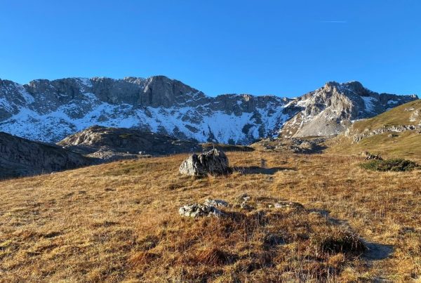
Tovarnica on Zelengora Mountain, Part of Natural Park Sutjeska
The park was established in 1962 and includes the Tjentišta valley, the Sutjeska river, parts of the Maglić, Volujak, and Zelengora mountains, and the Perućica rainforest. The Perućica rainforest is a strict nature reserve and the most preserved and largest rainforest in Europe, or as some would say the last one in Europe. It has been strictly protected from human intervention since the establishment of the National Park.
The Sutjeska National Park boasts a rich and diverse stock of game and rare plant species, many of which are endemic to the area. The park manages a hunting ground that is three times larger than the park itself. Its wealth of flora and fauna makes it a rarity in Europe and is one of the reasons for its admission to the EUROPARC federation. Additionally, due to its beauty, untouched nature, and values, the park was given the II category of the IUCN (United Nations Department for the Protection of Nature and Natural Resources) in 2000.
The Sutjeska National Park offers 300 beds in the Mladost Hotel and the Youth Center in Tjentište. Additionally, there are 12 beds available in mountain houses on Orlovačko Lake, Donje Bare Lake and Bogunovac. Tjentište also boasts a modern sports and recreation center with a football stadium, small sports fields, and a large outdoor swimming pool covering an area of approximately 16,000 square meters. The park’s facilities and infrastructure support the organization of the national triathlon competition each year at Tjentište.
The rangers and guides of the Sutjeska National Park play an important role in preserving the park’s native nature and maintaining a high level of protection for the highest mountains in Bosnia and Herzegovina. They are highly skilled and experienced guides who not only provide visitors with an immersive experience of the park’s wild beauty but also ensure the maximum safety for visitors. They are the best guides for exploring these mountains.
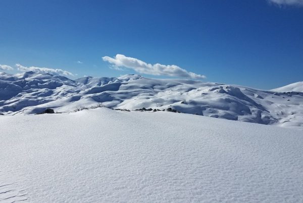
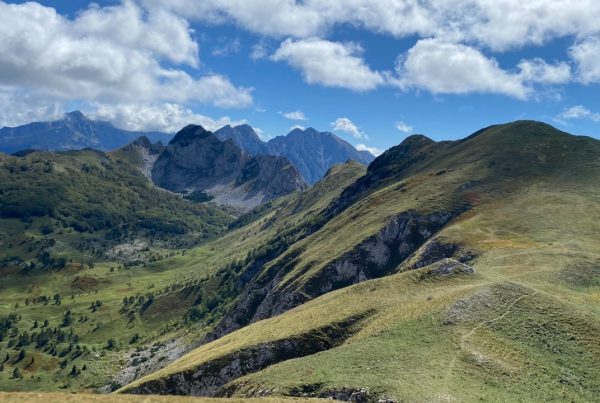
The Sutjeska National Park offers a diverse range of natural beauty for visitors to enjoy, from gentle valleys and dense forest complexes to mountain pastures and high mountain massifs.
One notable area within the park is Zelengora, which features eight glacial lakes, known as “mountain eyes,” as well as imposing canyons such as Sutjeska, Hrčavka, and Jabučnica. The park also features clear mountain rivers that are abundant with brown trout, making it a popular spot for fishing.
The Sutjeska National Park area is home to numerous historical monuments, both old and recent. The Battle of Sutjeska, also known as the Fifth Offensive or “Operation Schwarz,” took place from May 15 to June 15 in the areas of Montenegro, eastern Herzegovina, and eastern Bosnia. The final and bloodiest battles occurred in the area of the Sutjeska river and the surrounding mountains.
In memory of this significant historical event, a memorial complex was built in Tjentište. The central component of the complex is a monumental monument built by academic sculptor Miodrag Živković, as well as the Battle of Sutjeska Memorial House, an architectural masterpiece designed by Belgrade architect Ranko Radović. The Sutjeska National Park is managed by the Public Institution National Park “Sutjeska,” which is headquartered in Tjentište.
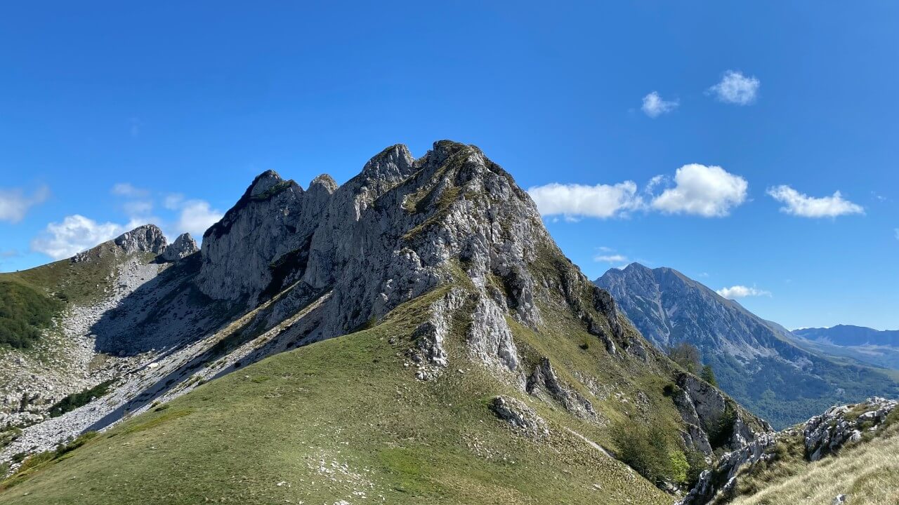
The Sutjeska National Park is home to several notable mountain ranges, including:
- Maglić
- Volujak
- Zelengora
Each of these mountains offer unique features and opportunities for visitors, such as hiking trails, scenic views, and historical significance. You can find more detailed information about these mountains on the links provided:
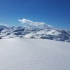
Zelengora – considered one of the most beautiful and tame mountains in the Sutjeska National Park.
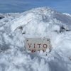
Maglić – The highest peak in Bosnia, Maglić mountain.
Volujak – Hiking Routes On Volujak, Second Highest Bosnian Mountain.
Perućica Rainforest is a European jewel located in the heart of the National Park Sutjeska
The Perućica rainforest has managed to survive as a rainforest due to a combination of circumstances. Logging companies see the large amount of high-quality wood available, but are not allowed to enter the rainforest with machines and cut it down. On the other hand, scientists view it as one of the last remaining primeval forests in Europe, making it a valuable resource for research and conservation.
The area of this unique rainforest reserve, which was created about 20,000 years ago during the Ice Age, is about 1,300 hectares. It has an oval shape, six kilometers long and three and a half kilometers wide. The highest part of Perucica is inaccessible to humans. It is located at the very foot of the mountains Volujak and Maglić, next to the Dragoš pass, and descends almost to the river Sutjeska, at 612 meters above sea level.
The heart of the rainforest is home to the beautiful Skakavac waterfall, which is 80 meters high and its water, like the Perućki stream, flows into the Sutjeska river. The rainforest received the highest level of protection as part of its special status and is the only rainforest in Europe which makes it a unique and precious place for conservation and scientific research.
Today, Perućica, as the last European primeval forest, attracts nature lovers with its wildness, beauty, diversity, and richness of flora and fauna. It is a potential tourist asset for Bosnia and Herzegovina. The tallest trees in Europe can be found in the Perućica rainforest, reaching over fifty, sixty and even more meters in height. Spruce, fir, white and black pine, beech, maple, and ash trees are prevalent in the forest. Some examples of real giants include the “three sisters” three spruces, which are 65 meters high and estimated to be hundreds of years old. The richness of Perućica’s ecosystem is also indicated by the data on the registered 170 species of trees and shrubs, two thousand species of herbaceous plants, many of which are endemic, and more than 90 species of butterflies.
In addition to the brown bear, the lynx, wild cat, chamois, and numerous species of snakes also inhabit the Perućica rainforest. Due to its inaccessibility, much of the forest remains unexplored. Radomir Lakušić, one of the greatest naturalists, claimed that Perućica is home to the most medicinal herbs and the most poisonous species of snakes in Europe. For this reason, among others, the Perućica rainforest is one of the grandest, most important, and best-preserved nature reserves in Europe and also serves as an open-air classroom for naturalists of various disciplines such as biologists, zoologists, foresters and more from all over the world.
There is a local legend among the people of the region, that tells of an elite unit of the German army that carelessly entered the Perućica rainforest during the famous “Battle of the Sutjeska” in 1943 and never returned. While this story is not confirmed, it adds to the mystique and intrigue surrounding the inaccessibility and dense wilderness of the Perućica rainforest.
Hiking through Perućica, the best tour in the Sutjeska National Park
The Perućica rainforest can be accessed from Tjentište by driving 14 km on an asphalt and macadam road to Dragoš pass. Once you reach the pass, a 200 m long visible path leads from the spacious plateau to the lookout point, which is a must-see destination in the area and offers a spectacular view of the Perućica rainforest and the surrounding mountains of Volujak and Zelengora. This lookout point is a great spot to take in the natural beauty of the area and get an overview of the forest. It’s a great place for photography and enjoying nature.
From the lookout point, you will have a clear view of the central part of the primeval forest, including the Skakavac waterfall which is almost one hundred meters high, where the water of the Perućica stream falls. The viewpoint itself offers a panoramic view of the forest, where you can see the huge pine and fir trees that give the landscape its natural beauty. This viewpoint gives a perfect perspective of the grandeur of the rainforest and the waterfall. It’s a great place to take in the natural beauty of the area and appreciate the unique ecosystem of the Perućica rainforest.
The marked pedestrian path to the Perućica rainforest starts from the Dragos pass, right next to the monument of Partisan commander Nurija Pozderac. This trail takes you along the upper edge of the primeval forest and offers a chance to truly experience the wilderness of Perućica. For the more experienced hikers and nature enthusiasts, the trail also provides an opportunity to take on the challenge of an unmarked path to the top of the Skakavac waterfall. This path is less trodden and provides a chance to explore the dense forest and waterfall in a more secluded and untouched way. Keep in mind that this path is not safe for people who are not familiar with hiking and it is always recommended to go with a guide.
Hiking through the Perućica rainforest offers different experiences throughout the year. However, it’s not recommended to visit during winter as the trail can be dangerous and the waterfall is frozen. For those visiting the area for the first time, it is highly recommended to have a guide, or good mountaineering experience, a map and a good knowledge of the topography. The trail begins at Dragos pass, less than a hundred meters above the pass, next to the macadam road towards Vucevo, next to the monument of Nurija Pozderac. This marked hiking trail is a great way to experience the beauty of the rainforest and its unique ecosystem, but it’s important to be prepared and aware of the potential risks.
The road starts with an isohypse of 1280 meters, gradually descending to a series of smaller streams which will eventually flow into the Perućica stream. High and dense thickets of various trees almost obscure the sky, creating deep shadows in some parts of the ancient forest. Individual trees stand out for their size and height; firs and spruces, pines and beeches, black and white alder, oak, and hornbeam are all unusually tall. Occasionally, the road is blocked by fallen, rotted trees, giving the ancient forest a special atmosphere.
After travelling less than 100 meters, the road descends at the crossing over the Prijevorski potok stream. From there, the marked path begins to slightly ascend, taking you along the upper edge of the primeval forest. For those seeking a more thrilling experience, the road branches off to the right, heading northwest down the stream and into the depths of the primeval forest.
Hiking through the Perućica rainforest can be challenging, as the forest is so dense that it is difficult to navigate using landmarks and sky visibility is limited. The best way to navigate is by using a compass and following the direction of the stream. After less than a kilometer, the right bank of the stream will provide easy access to the rock from which the waterfalls drop. The Skakavac waterfall has two waterfalls in total. It’s important to note that this trail is not recommended for beginners and it’s always recommended to go with a guide who knows the area well and can provide safe navigation through the dense forest.
The Skakavac waterfall has two waterfalls in total, the first one is located at the beginning of the rock and can be reached by carefully climbing, following the right bank of the stream, and crossing a steep slope a few meters above. From this vantage point, one can see the first, smaller waterfall, which is ten meters high. To see the larger waterfall up close, one must go back about twenty meters and climb up the steep right bank of the stream. After about fifty meters of climbing, a beautiful view of the waterfall appears, but it is necessary to climb another hundred meters, to the large pine trees, under which the waterfall can be viewed from a bird’s-eye perspective. It’s important to note that this trail is not recommended for beginners and it’s always recommended to go with a guide who knows the area well and can provide safe navigation through the dense forest. Also, when climbing close to the water fall, one must be very careful as it requires a lot of concentration and attention to be able to take a picture safely.
The return to the marked trail leads on the other side of the stream, in a southerly direction, uphill and takes about half an hour of easy walking. The marked hiking path, passing along the upper edge of the forest, will quickly lead us to the Tunjemir Pass at almost the same elevation as the starting point, and the crossroads towards Prijevor uphill and Suha river downhill. Climbing to Prijevor takes less than two hours, and descending to Suha river takes less than an hour. Along the way, you will occasionally see the rocks of Tunjemir to the right and the Volujak mountains to the left across the Suha river valley. The trail ends less than a kilometer from the Sutjeska canyon and from there we descend on the macadam road that goes from Suha towards Trnovačko Lake. The return journey is via Suha and Sutjeska canyon to Tjentište, a distance of 5 kilometers. It’s important to note that this trail is not recommended for beginners and it’s always recommended to go with a guide who knows the area well and can provide safe navigation through the dense forest.
Rivers in National Park Sutjeska
The National Park of Sutjeska is home to a number of clear mountain rivers that flow through the park’s rugged landscape. These rivers are known for their diverse ecosystems and are teeming with a variety of fish species, including brown trout. The rivers in this area are also fed by a number of natural springs and are surrounded by lush vegetation and dense forests. The rivers in the park are popular among hikers, anglers, and nature enthusiasts, who come to enjoy the natural beauty of the area and explore the park’s rich biodiversity. Overall, the rivers in the National Park of Sutjeska are an important part of the park’s ecosystem, and are a major draw for visitors looking to experience the wild beauty of this magical landscape.
Sutjeska River
The Sutjeska River is small in terms of water volume, but it is extremely significant in terms of natural wealth and history. It springs from under the Volujak mountain at an elevation of 1665 meters and flows into the Drina River at an elevation of 387 meters, with a natural fall of 1179 meters. The name “Sutjeska” means a strait or a gorge and it refers to the canyon on the way out from Tjentište, across Suha and further towards the town of Gacko. The river is fast, clean, and sparkling, rich in trout and its natural water, the pool at Tjentište, the largest open pool in Southeast Europe. In the Middle Ages, the Foča-Via Ragusa trade caravan route ran along almost the entire course of the Sutjeska river. In the rocks of Vratar, above Suha, in the 14th century, there was a customs house of Herceg Šćepan Kosača, a medieval Serbian prefect. Today’s Šćepan Polje was named after him. It’s important to note that the canyon and the river are important tourist attractions and many visitors come to see the natural beauty of the area.
The Hrčavka River
The Hrčavka River is a left tributary of the Sutjeska and it rises on Zelengora, between Ljubin Grob and Planika, at an elevation of 1570 meters. The river is 13.5 kilometers long and its unusually cold water flows through a picturesque canyon, full of cascades and rock pools. Three kilometers upstream from the bend in Sutjesko, there are the remains of the Serbian medieval town of Tođevac. The Hrčavka canyon is a popular spot for visitors and offers many opportunities for hiking, swimming and exploring. It’s also known for its waterfalls and cascades which are located below the remains of the medieval town of Tođevac.
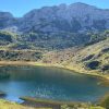
Lakes in National Park Sutjeska
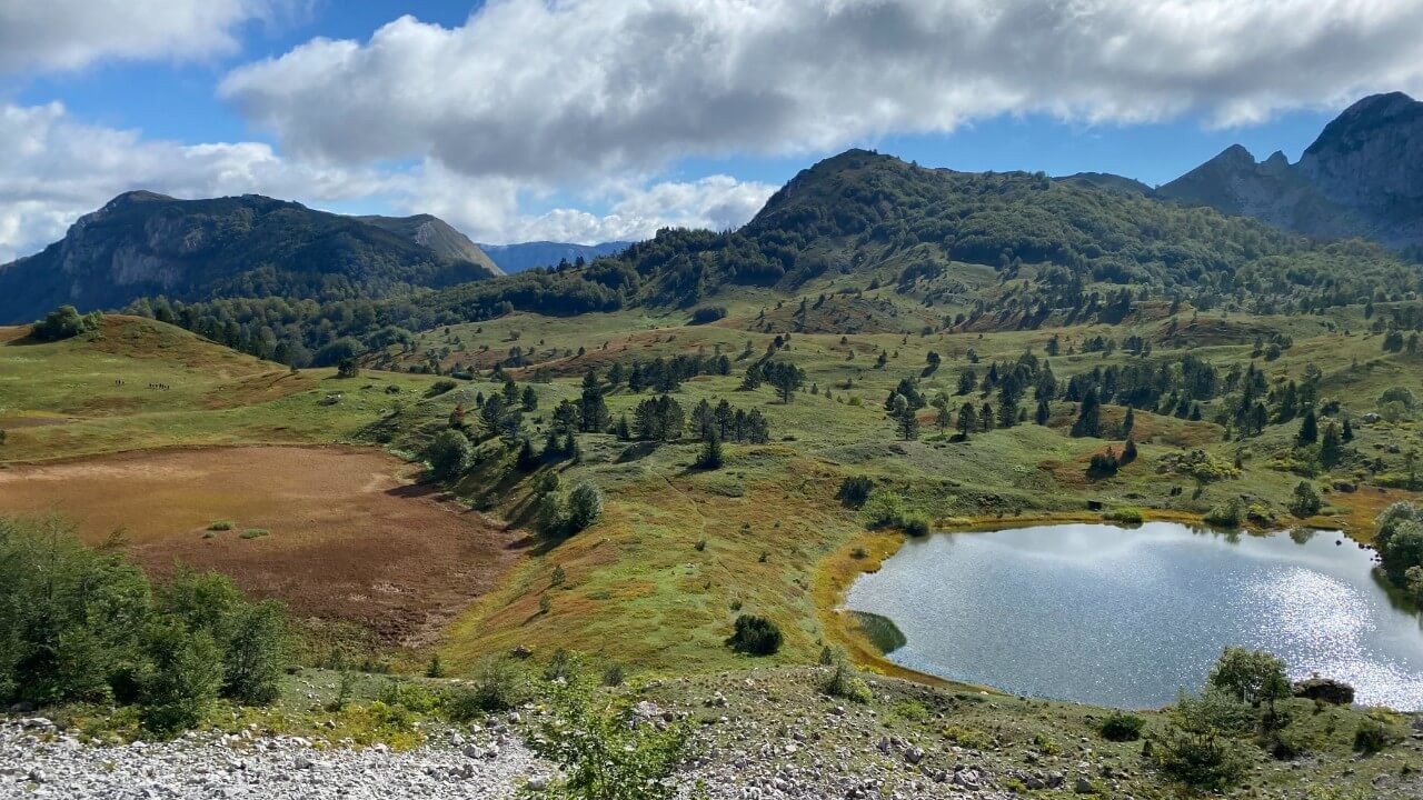
The National Park of Sutjeska is also home to a diverse array of glacial lakes, also known as “mountain eyes”. These lakes are surrounded by picturesque mountain ranges and lush forests, making them popular destinations for hikers and nature enthusiasts. Many of the lakes are rich in fish, such as trout, and offer opportunities for fishing and swimming. Some of the lakes are also located near historic sites, such as medieval towns, adding to the overall experience of visiting the National Park of Sutjeska.
Lake Donje Bare
Lake Donje Bare is located in the Sutjeska National Park, under Tovarnica, which covers the Sutjeska canyon. The lake is located at an elevation of 1500 meters, it is 200 meters long and 140 meters wide, with a depth of about four meters. It is rich in trout and is a popular spot for fishing. The lake is accessible via a 19 km long forest road from Tjentište. Next to the lake, there is a mountain hut, owned by the Sutjeska National Park, which provides accommodation for visitors and hikers. The hut is equipped with basic facilities and offers a great opportunity to experience the natural beauty and serenity of the lake and the surrounding area.
Lake Gornje Bare
Gornje Bare is a lake located two kilometers above Donje Bare Lake, at an altitude of 1550 meters. The lake is formed by a glacial cirque and is not rich in fish due to the large amount of snow that falls every winter in that area. The lake can be reached by the same road as Donje Bare Lake, which starts from Tjentište.
Crno Lake
Crno Lake is known for its unique and picturesque setting, surrounded by dense forests and towering peaks. It is a popular destination for hikers and nature enthusiasts, offering a chance to experience the natural beauty of Zelengora and the surrounding area. The lake is not suitable for swimming due to its muddy bottom, but it offers a peaceful and secluded spot for camping, picnicking and bird-watching. The nearby Stari Katun, the traditional summer huts of local herders, is also a popular spot for visitors to explore and experience the traditional way of life in the region.
Bijelo Lake
Fifteen minutes’ walk from Black Lake, below Trebova Gora, at an altitude of 1417 meters, there is Bijelo Lake, round in shape and beautiful, clean water, suitable for swimming. It is called Bijelo (White) because of the white limestone slabs that adorn its bottom. It is fed by two living water sources. Blueberries, cranberries and numerous medicinal herbs grow around the lake, and above the lake there is a path towards Ljubin Grob.
Orlovačko Lake
Nestled among the peaks of Stog, Ljeljen and Orlovac at an altitude of 1,500 meters lies Orlovačko lake, a glacial lake renowned for its beauty and rich trout population. The lake’s crystal-clear water, which basks in the sun’s rays, makes it a popular destination for outdoor enthusiasts. Visitors can access the lake via a 23-kilometer long forest road from Čemerno or directly from Tjentište.
Kotlaničko Lake
The Kotlaničko Lake is a unique natural wonder situated four kilometers away from the Štirinsko Lake. The lake is fed by multiple springs both around and at the bottom of the lake, resulting in a constant circulation of water. This ensures that the lake is exceptionally rich in fish, making it a popular spot for fishing enthusiasts. Its location on the Zelengora mountain range and proximity to other natural wonders makes it a must-visit destination for nature lovers and outdoor enthusiasts.
Borilovacko Lake
Borilovačko Lake, just a short 10-minute walk from Orlovačko Lake, sits at an elevation of 1550 meters and is teeming with fish, offering visitors a chance to indulge in fishing while taking in the stunning surroundings.
Štirinsko Lake
Štirinsko Lake is a hidden gem located on the Zelengora mountain, accessible only by a challenging three-hour hike from Orlovačko Lake. Although the lake’s small depth means that it freezes over in winter, making it uninhabitable for fish, the breathtaking views and serene atmosphere make the journey well worth it.
In summary, the National Park Sutjeska is a unique and diverse natural area in Bosnia and Herzegovina, known for its untouched wilderness, rich hunting ground, and rare plant and animal species. The park is home to several notable mountain ranges, including Zelengora, which is known for its picturesque glacial lakes, and the Perućica Rainforest, which is the only rainforest in Europe. The park also offers many recreational activities, such as hiking, and features several historical monuments and landmarks, including the Battle of Sutjeska Memorial House and the Skakavac waterfall. Visitors can also explore the park’s many rivers and lakes, such as the Sutjeska and Hrčavka rivers, Donje and Gornje Bare, Crno and Bijelo lakes, and Orlovačko lake, each of which offers its own unique natural beauty and recreational opportunities.